A benchmark dataset for deep learning-based airplane detection: HRPlanes
2204.10959
0
0
🤿
Abstract
Airplane detection from satellite imagery is a challenging task due to the complex backgrounds in the images and differences in data acquisition conditions caused by the sensor geometry and atmospheric effects. Deep learning methods provide reliable and accurate solutions for automatic detection of airplanes; however, huge amount of training data is required to obtain promising results. In this study, we create a novel airplane detection dataset called High Resolution Planes (HRPlanes) by using images from Google Earth (GE) and labeling the bounding box of each plane on the images. HRPlanes include GE images of several different airports across the world to represent a variety of landscape, seasonal and satellite geometry conditions obtained from different satellites. We evaluated our dataset with two widely used object detection methods namely YOLOv4 and Faster R-CNN. Our preliminary results show that the proposed dataset can be a valuable data source and benchmark data set for future applications. Moreover, proposed architectures and results of this study could be used for transfer learning of different datasets and models for airplane detection.
Create account to get full access
Overview
- The paper presents a novel dataset called High Resolution Planes (HRPlanes) for airplane detection from satellite imagery.
- The dataset consists of Google Earth images of various airports around the world, with bounding boxes annotated for each plane.
- The authors evaluate the dataset using two popular object detection methods: YOLOv4 and Faster R-CNN.
- The proposed dataset and results could be useful for future research on airplane detection and transfer learning in this domain.
Plain English Explanation
Detecting airplanes in satellite images is a challenging task. This is because the background in these images can be very complex, and the way the images are captured can vary a lot, depending on factors like the satellite's position and the weather conditions.
To address this challenge, the researchers created a new dataset called HRPlanes. They used images from Google Earth to capture a variety of airport scenes from around the world, and then manually labeled the location of each airplane in the images.
The researchers then tested two popular object detection methods, YOLOv4 and Faster R-CNN, on this new dataset. The results showed that the HRPlanes dataset could be a valuable resource for future research on airplane detection and transfer learning in this area.
Technical Explanation
The authors created the HRPlanes dataset by collecting high-resolution satellite images from Google Earth, covering a variety of airports and landscapes around the world. They then manually annotated the bounding boxes of each airplane visible in the images.
The dataset was designed to represent diverse conditions, including different seasons, satellite geometries, and atmospheric effects, to challenge airplane detection algorithms. The authors evaluated the dataset using two popular object detection methods, YOLOv4 and Faster R-CNN, and reported their preliminary results.
The authors suggest that the HRPlanes dataset could serve as a valuable benchmark for future research on airplane detection and transfer learning in this domain.
Critical Analysis
The authors acknowledge that the dataset and the results presented in the paper are preliminary, and they suggest that further research is needed to fully evaluate the dataset's potential. One potential limitation is the lack of diversity in the types of airplanes included in the dataset, as it primarily focuses on commercial airliners.
Additionally, the paper does not provide much information about the specific challenges or errors encountered by the object detection algorithms when working with the HRPlanes dataset. Further analysis of the algorithm's performance and the types of errors it makes could provide valuable insights for improving airplane detection in satellite imagery.
It would also be interesting to see how the HRPlanes dataset compares to other drone detection or aircraft detection datasets in terms of complexity and the performance of state-of-the-art algorithms.
Conclusion
The HRPlanes dataset presented in this paper is a valuable contribution to the field of airplane detection from satellite imagery. The dataset's diversity in terms of airport locations, seasons, and satellite geometries makes it a potentially useful resource for training and evaluating detection algorithms.
The preliminary results using YOLOv4 and Faster R-CNN suggest that the dataset can be a good starting point for further research in this area, particularly in the context of transfer learning. Future work could focus on expanding the dataset, analyzing the specific challenges faced by detection algorithms, and comparing the performance of HRPlanes to other aircraft detection datasets.
This summary was produced with help from an AI and may contain inaccuracies - check out the links to read the original source documents!
Related Papers

FlightScope: A Deep Comprehensive Assessment of Aircraft Detection Algorithms in Satellite Imagery
Safouane El Ghazouali, Arnaud Gucciardi, Nicola Venturi, Michael Rueegsegger, Umberto Michelucci
0
0
Object detection in remotely sensed satellite pictures is fundamental in many fields such as biophysical, and environmental monitoring. While deep learning algorithms are constantly evolving, they have been mostly implemented and tested on popular ground-based taken photos. This paper critically evaluates and compares a suite of advanced object detection algorithms customized for the task of identifying aircraft within satellite imagery. Using the large HRPlanesV2 dataset, together with a rigorous validation with the GDIT dataset, this research encompasses an array of methodologies including YOLO versions 5 and 8, Faster RCNN, CenterNet, RetinaNet, RTMDet, and DETR, all trained from scratch. This exhaustive training and validation study reveal YOLOv5 as the preeminent model for the specific case of identifying airplanes from remote sensing data, showcasing high precision and adaptability across diverse imaging conditions. This research highlight the nuanced performance landscapes of these algorithms, with YOLOv5 emerging as a robust solution for aerial object detection, underlining its importance through superior mean average precision, Recall, and Intersection over Union scores. The findings described here underscore the fundamental role of algorithm selection aligned with the specific demands of satellite imagery analysis and extend a comprehensive framework to evaluate model efficacy. The benchmark toolkit and codes, available via https://github.com/toelt-llc/FlightScope_Bench, aims to further exploration and innovation in the realm of remote sensing object detection, paving the way for improved analytical methodologies in satellite imagery applications.
5/2/2024
🔎
Real-Time Flying Object Detection with YOLOv8
Dillon Reis, Jordan Kupec, Jacqueline Hong, Ahmad Daoudi
0
0
This paper presents a generalized model for real-time detection of flying objects that can be used for transfer learning and further research, as well as a refined model that achieves state-of-the-art results for flying object detection. We achieve this by training our first (generalized) model on a data set containing 40 different classes of flying objects, forcing the model to extract abstract feature representations. We then perform transfer learning with these learned parameters on a data set more representative of real world environments (i.e. higher frequency of occlusion, very small spatial sizes, rotations, etc.) to generate our refined model. Object detection of flying objects remains challenging due to large variances of object spatial sizes/aspect ratios, rate of speed, occlusion, and clustered backgrounds. To address some of the presented challenges while simultaneously maximizing performance, we utilize the current state-of-the-art single-shot detector, YOLOv8, in an attempt to find the best trade-off between inference speed and mean average precision (mAP). While YOLOv8 is being regarded as the new state-of-the-art, an official paper has not been released as of yet. Thus, we provide an in-depth explanation of the new architecture and functionality that YOLOv8 has adapted. Our final generalized model achieves a mAP50 of 79.2%, mAP50-95 of 68.5%, and an average inference speed of 50 frames per second (fps) on 1080p videos. Our final refined model maintains this inference speed and achieves an improved mAP50 of 99.1% and mAP50-95 of 83.5%
5/24/2024
🔎
Insight Into the Collocation of Multi-Source Satellite Imagery for Multi-Scale Vessel Detection
Tran-Vu La, Minh-Tan Pham, Marco Chini
0
0
Ship detection from satellite imagery using Deep Learning (DL) is an indispensable solution for maritime surveillance. However, applying DL models trained on one dataset to others having differences in spatial resolution and radiometric features requires many adjustments. To overcome this issue, this paper focused on the DL models trained on datasets that consist of different optical images and a combination of radar and optical data. When dealing with a limited number of training images, the performance of DL models via this approach was satisfactory. They could improve 5-20% of average precision, depending on the optical images tested. Likewise, DL models trained on the combined optical and radar dataset could be applied to both optical and radar images. Our experiments showed that the models trained on an optical dataset could be used for radar images, while those trained on a radar dataset offered very poor scores when applied to optical images.
5/24/2024
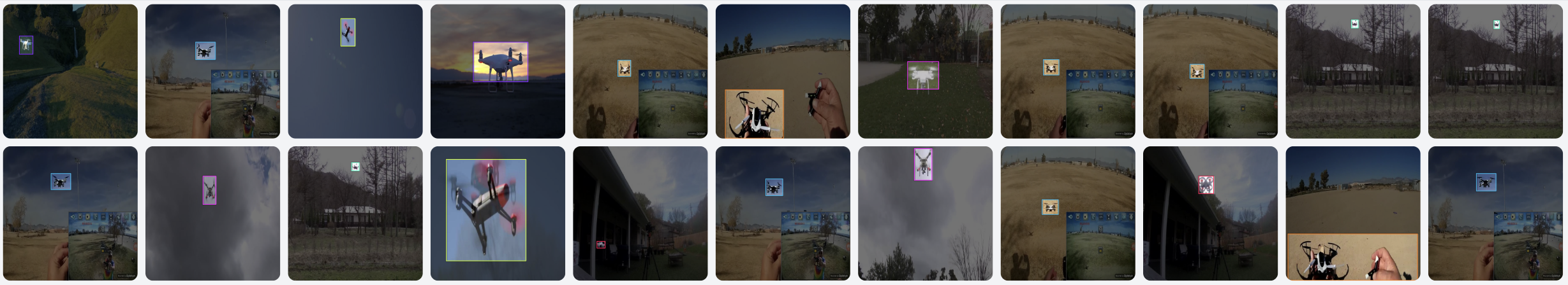
Drone-type-Set: Drone types detection benchmark for drone detection and tracking
Kholoud AlDosari, AIbtisam Osman, Omar Elharrouss, Somaya AlMaadeed, Mohamed Zied Chaari
0
0
The Unmanned Aerial Vehicles (UAVs) market has been significantly growing and Considering the availability of drones at low-cost prices the possibility of misusing them, for illegal purposes such as drug trafficking, spying, and terrorist attacks posing high risks to national security, is rising. Therefore, detecting and tracking unauthorized drones to prevent future attacks that threaten lives, facilities, and security, become a necessity. Drone detection can be performed using different sensors, while image-based detection is one of them due to the development of artificial intelligence techniques. However, knowing unauthorized drone types is one of the challenges due to the lack of drone types datasets. For that, in this paper, we provide a dataset of various drones as well as a comparison of recognized object detection models on the proposed dataset including YOLO algorithms with their different versions, like, v3, v4, and v5 along with the Detectronv2. The experimental results of different models are provided along with a description of each method. The collected dataset can be found in https://drive.google.com/drive/folders/1EPOpqlF4vG7hp4MYnfAecVOsdQ2JwBEd?usp=share_link
5/20/2024