Generalizable Disaster Damage Assessment via Change Detection with Vision Foundation Model

0

Sign in to get full access
Overview
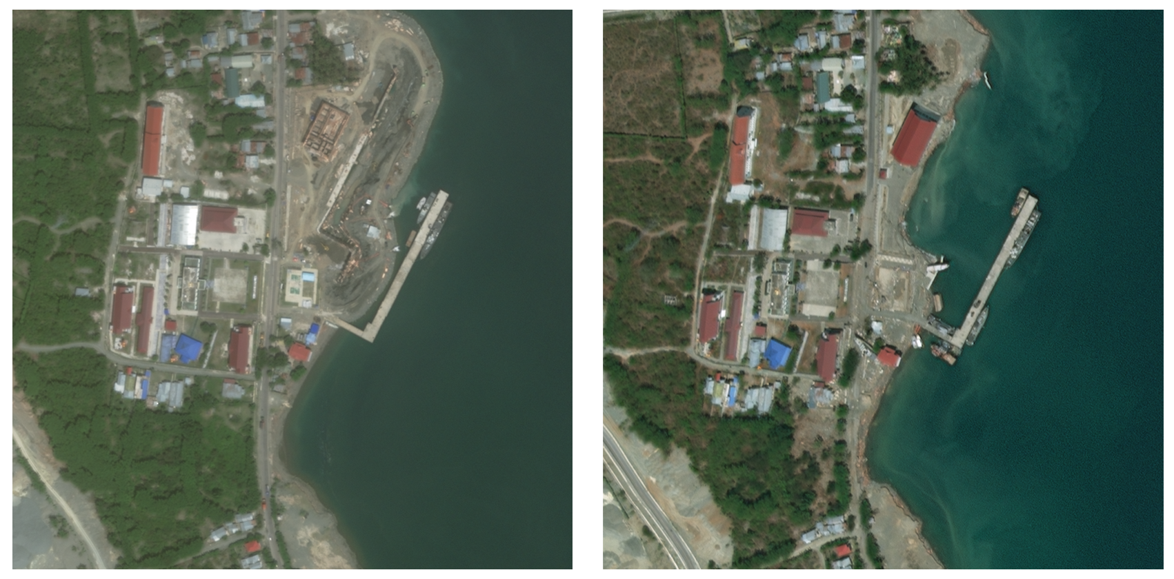
- This paper presents a generalized approach for disaster damage assessment using satellite imagery and a vision foundation model.
- The method leverages unsupervised change detection to identify damaged areas without the need for labeled training data.
- A label refinement step is used to further improve the damage assessments.
- The approach is demonstrated to be effective across multiple disaster scenarios, showcasing its generalizability.
Plain English Explanation
This research paper describes a new way to assess damage from natural disasters using satellite images. Traditional methods often require labeled training data, which can be time-consuming and expensive to obtain. Instead, this approach uses a vision foundation model - a powerful AI model that can understand the content of images without being explicitly trained on disaster-related data.
The key innovation is the use of unsupervised change detection. The model looks for differences between images taken before and after a disaster, allowing it to identify areas that have been damaged without needing any labeled examples. This makes the approach generalizable - it can be applied to different types of disasters without having to retrain the model.
After the initial change detection, the system goes through a label refinement step to further improve the accuracy of the damage assessments. This combines the change detection with other visual cues to more precisely distinguish between damaged and undamaged areas.
The researchers demonstrate the effectiveness of their approach on multiple real-world disaster scenarios, showing that it can provide detailed and reliable damage assessments without requiring expensive labeled datasets or manual annotation. This has the potential to significantly streamline and scale disaster response efforts.
Technical Explanation
The paper presents a generalized disaster damage assessment framework that leverages a vision foundation model and unsupervised change detection. The key components are:
-
Disaster Change Detection: The system takes pre- and post-disaster satellite images and uses the vision foundation model to extract visual features. It then compares these features to identify areas that have changed, indicating potential damage.
-
Label Refinement: The initial change detection is further refined using additional visual cues to more accurately distinguish between damaged and undamaged regions. This includes analyzing texture, color, and geometric patterns in the imagery.
-
Generalizability: The approach is designed to be generalizable across different disaster types and locations. It does not require any disaster-specific training data, allowing it to be rapidly deployed in new scenarios.
The researchers evaluate their framework on several real-world disaster case studies, including hurricanes, earthquakes, and wildfires. They demonstrate that the unsupervised change detection, combined with the label refinement, can provide highly accurate damage assessments compared to ground truth data. Importantly, the system maintains its performance without needing to be retrained for each new disaster scenario.
Critical Analysis
The authors acknowledge that their approach, while generalized, may still have some limitations in certain disaster contexts. For example, the change detection could be challenged by factors like weather conditions, sensor degradation, or subtle damage patterns. Additionally, the label refinement step relies on visual cues that may not be present or reliable in all types of disasters.
While the paper showcases impressive results, further research could explore ways to make the system even more robust and adaptive. This may involve incorporating additional data sources (e.g., social media, infrastructure maps) or developing more sophisticated change detection and labeling algorithms.
Additionally, the ethical implications of automated disaster assessment systems should be carefully considered. Issues around data privacy, algorithmic bias, and the potential for misuse or over-reliance on the technology will need to be addressed as this field continues to evolve.
Conclusion
This research presents a novel approach for generalizable disaster damage assessment using a vision foundation model and unsupervised change detection. By avoiding the need for labeled training data, the system can be rapidly deployed to new disaster scenarios, streamlining the damage evaluation process.
The demonstrated effectiveness across multiple case studies suggests this framework could have significant real-world impact, helping to guide faster and more efficient disaster response efforts. As the technology continues to advance, it will be important to address potential limitations and ethical concerns to ensure these systems are developed and deployed responsibly.
This summary was produced with help from an AI and may contain inaccuracies - check out the links to read the original source documents!
Related Papers
0
Generalizable Disaster Damage Assessment via Change Detection with Vision Foundation Model
Kyeongjin Ahn, Sungwon Han, Sungwon Park, Jihee Kim, Sangyoon Park, Meeyoung Cha
The increasing frequency and intensity of natural disasters demand more sophisticated approaches for rapid and precise damage assessment. To tackle this issue, researchers have developed various methods on disaster benchmark datasets from satellite imagery to aid in detecting disaster damage. However, the diverse nature of geographical landscapes and disasters makes it challenging to apply existing methods to regions unseen during training. We present DAVI (Disaster Assessment with VIsion foundation model), which overcomes domain disparities and detects structural damage (e.g., building) without requiring ground-truth labels of the target region. DAVI integrates task-specific knowledge from a model trained on source regions with an image segmentation foundation model to generate pseudo labels of possible damage in the target region. It then employs a two-stage refinement process, targeting both the pixel and overall image, to more accurately pinpoint changes in disaster-struck areas based on before-and-after images. Comprehensive evaluations demonstrate that DAVI achieves exceptional performance across diverse terrains (e.g., USA and Mexico) and disaster types (e.g., wildfires, hurricanes, and earthquakes). This confirms its robustness in assessing disaster impact without dependence on ground-truth labels.
Read more6/13/2024
0
DeepDamageNet: A two-step deep-learning model for multi-disaster building damage segmentation and classification using satellite imagery
Irene Alisjahbana (Mullet), Jiawei Li (Mullet), Ben (Mullet), Strong, Yue Zhang
Satellite imagery has played an increasingly important role in post-disaster building damage assessment. Unfortunately, current methods still rely on manual visual interpretation, which is often time-consuming and can cause very low accuracy. To address the limitations of manual interpretation, there has been a significant increase in efforts to automate the process. We present a solution that performs the two most important tasks in building damage assessment, segmentation and classification, through deep-learning models. We show our results submitted as part of the xView2 Challenge, a competition to design better models for identifying buildings and their damage level after exposure to multiple kinds of natural disasters. Our best model couples a building identification semantic segmentation convolutional neural network (CNN) to a building damage classification CNN, with a combined F1 score of 0.66, surpassing the xView2 challenge baseline F1 score of 0.28. We find that though our model was able to identify buildings with relatively high accuracy, building damage classification across various disaster types is a difficult task due to the visual similarity between different damage levels and different damage distribution between disaster types, highlighting the fact that it may be important to have a probabilistic prior estimate regarding disaster damage in order to obtain accurate predictions.
Read more5/9/2024
📊
0
Robust Disaster Assessment from Aerial Imagery Using Text-to-Image Synthetic Data
Tarun Kalluri, Jihyeon Lee, Kihyuk Sohn, Sahil Singla, Manmohan Chandraker, Joseph Xu, Jeremiah Liu
We present a simple and efficient method to leverage emerging text-to-image generative models in creating large-scale synthetic supervision for the task of damage assessment from aerial images. While significant recent advances have resulted in improved techniques for damage assessment using aerial or satellite imagery, they still suffer from poor robustness to domains where manual labeled data is unavailable, directly impacting post-disaster humanitarian assistance in such under-resourced geographies. Our contribution towards improving domain robustness in this scenario is two-fold. Firstly, we leverage the text-guided mask-based image editing capabilities of generative models and build an efficient and easily scalable pipeline to generate thousands of post-disaster images from low-resource domains. Secondly, we propose a simple two-stage training approach to train robust models while using manual supervision from different source domains along with the generated synthetic target domain data. We validate the strength of our proposed framework under cross-geography domain transfer setting from xBD and SKAI images in both single-source and multi-source settings, achieving significant improvements over a source-only baseline in each case.
Read more5/24/2024

0
Cross-View Geolocalization and Disaster Mapping with Street-View and VHR Satellite Imagery: A Case Study of Hurricane IAN
Hao Li, Fabian Deuser, Wenping Yina, Xuanshu Luo, Paul Walther, Gengchen Mai, Wei Huang, Martin Werner
Nature disasters play a key role in shaping human-urban infrastructure interactions. Effective and efficient response to natural disasters is essential for building resilience and a sustainable urban environment. Two types of information are usually the most necessary and difficult to gather in disaster response. The first information is about disaster damage perception, which shows how badly people think that urban infrastructure has been damaged. The second information is geolocation awareness, which means how people whereabouts are made available. In this paper, we proposed a novel disaster mapping framework, namely CVDisaster, aiming at simultaneously addressing geolocalization and damage perception estimation using cross-view Street-View Imagery (SVI) and Very High-Resolution satellite imagery. CVDisaster consists of two cross-view models, where CVDisaster-Geoloc refers to a cross-view geolocalization model based on a contrastive learning objective with a Siamese ConvNeXt image encoder, and CVDisaster-Est is a cross-view classification model based on a Couple Global Context Vision Transformer (CGCViT). Taking Hurricane IAN as a case study, we evaluate the CVDisaster framework by creating a novel cross-view dataset (CVIAN) and conducting extensive experiments. As a result, we show that CVDisaster can achieve highly competitive performance (over 80% for geolocalization and 75% for damage perception estimation) with even limited fine-tuning efforts, which largely motivates future cross-view models and applications within a broader GeoAI research community. The data and code are publicly available at: https://github.com/tum-bgd/CVDisaster.
Read more8/14/2024