Pansharpening of PRISMA products for archaeological prospection

0
🌐
Sign in to get full access
Overview
- Satellite-based hyperspectral data often has low spatial resolution, making it less suitable for archaeological prospection.
- Airborne hyperspectral sensors have shown promise in identifying archaeological features, but satellite imagery could be more practical if the resolution was improved.
- This research evaluates the use of pan-sharpened PRISMA satellite products for detecting subsurface archaeological features.
- Three pan-sharpening methods are compared and tested over the archaeological landscape of Aquileia, Italy.
Plain English Explanation
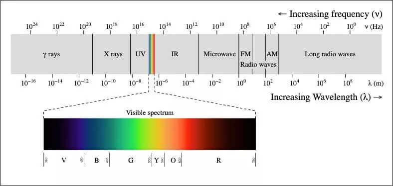
Satellite-based hyperspectral data, which collects information across a wide range of wavelengths, typically has a low level of spatial detail or resolution. This makes it less useful for exploring archaeological sites, as the fine details needed to identify buried features are often missing. On the other hand, hyperspectral data collected from aircraft has shown promise for this type of archaeological prospecting, but using planes has drawbacks compared to satellites.
To make satellite hyperspectral data more useful for archaeology, the researchers in this study tested ways to "sharpen" the images to increase the spatial resolution. They compared three different pan-sharpening techniques and applied them to PRISMA satellite imagery over the archaeological site of Aquileia, Italy. Pan-sharpening is a process that combines the high-resolution grayscale information from a panchromatic (single-band) image with the more detailed spectral information from a lower-resolution hyperspectral image.
The results suggest that using pan-sharpening can indeed make satellite hyperspectral data much more suitable for identifying both small and large subsurface archaeological features, provided the process is carried out correctly. This could make satellite-based prospecting a more practical option for archaeologists compared to relying solely on airborne data collection.
Technical Explanation
The research compared three pan-sharpening methods - GSA, MTF-GLP, and HySure - to enhance the spatial resolution of PRISMA satellite hyperspectral imagery over the archaeological site of Aquileia, Italy. PRISMA is an Italian satellite that collects hyperspectral data.
The pan-sharpening techniques combined the high-resolution panchromatic (single-band) data from the satellite with the lower-resolution hyperspectral data to produce imagery with improved spatial detail. The researchers then evaluated the resulting pan-sharpened products both quantitatively, using established metrics, and qualitatively by visual inspection.
The results indicate that under certain conditions, the application of pan-sharpening can make satellite hyperspectral data highly suitable for identifying both small and large subsurface archaeological features. This is a significant finding, as the low spatial resolution of satellite hyperspectral data has historically limited its usefulness for archaeological prospection compared to data collected from airborne sensors.
Critical Analysis
The paper acknowledges that the effectiveness of the pan-sharpening methods is dependent on the specific conditions, such as the characteristics of the archaeological landscape and the quality of the satellite data. More research may be needed to understand the full scope of applicability and limitations of this approach.
Additionally, the study focused on a single archaeological site, so further testing across a wider range of sites and environments would help validate the generalizability of the findings. The authors also note that additional comparison to airborne hyperspectral data could provide valuable insights.
While the results are promising, readers should consider the potential tradeoffs and challenges involved in relying on pan-sharpened satellite imagery for archaeological prospection, such as factors related to cost, availability, and temporal resolution compared to airborne data collection.
Conclusion
This research demonstrates that the use of pan-sharpening techniques can significantly enhance the suitability of satellite-based hyperspectral imagery for archaeological prospection. By increasing the spatial resolution, the pan-sharpened products were able to better detect both small and large subsurface archaeological features at the Aquileia site.
These findings suggest that satellite hyperspectral data, when properly processed, could become a more practical and accessible alternative to airborne sensors for certain archaeological applications. This could potentially expand the geographic reach and cost-effectiveness of remote sensing-based archaeological exploration and discovery.
However, the specific conditions for successful application must be further explored, and the approach should be validated across a wider range of archaeological landscapes. Continued research in this area may lead to improved tools and techniques for leveraging satellite hyperspectral data in the service of cultural heritage protection and understanding.
This summary was produced with help from an AI and may contain inaccuracies - check out the links to read the original source documents!
Related Papers
🌐
0
Pansharpening of PRISMA products for archaeological prospection
Gregory Sech, Giulio Poggi, Marina Ljubenovic, Marco Fiorucci, Arianna Traviglia
Hyperspectral data recorded from satellite platforms are often ill-suited for geo-archaeological prospection due to low spatial resolution. The established potential of hyperspectral data from airborne sensors in identifying archaeological features has, on the other side, generated increased interest in enhancing hyperspectral data to achieve higher spatial resolution. This improvement is crucial for detecting traces linked to sub-surface geo-archaeological features and can make satellite hyperspectral acquisitions more suitable for archaeological research. This research assesses the usability of pansharpened PRISMA satellite products in geo-archaeological prospections. Three pan-sharpening methods (GSA, MTF-GLP and HySure) are compared quantitatively and qualitatively and tested over the archaeological landscape of Aquileia (Italy). The results suggest that the application of pansharpening techniques makes hyperspectral satellite imagery highly suitable, under certain conditions, to the identification of sub-surface archaeological features of small and large size.
Read more4/9/2024
0
Spectral Fidelity and Spatial Enhancement: An Assessment and Cascading of Pan-Sharpening Techniques for Satellite Imagery
Abdul Aziz A. B, A. B Abdul Rahim
This research presents a comprehensive assessment of pan-sharpening techniques for satellite imagery, focusing on the critical aspects of spectral fidelity and spatial enhancement. Motivated by the need for informed algorithm selection in remote sensing, A novel cascaded and structured evaluation framework has been proposed with a detailed comparative analysis of existing methodologies. The research findings underscore the intricate trade-offs between spectral accuracy of about 88% with spatial resolution enhancement. The research sheds light on the practical implications of pan-sharpening and emphasizes the significance of both spectral and spatial aspects in remote sensing applications. Various pan-sharpening algorithms were systematically employed to provide a holistic view of their performance, contributing to a deeper understanding of their capabilities and limitations.
Read more5/30/2024

0
Hyperspectral Pansharpening: Critical Review, Tools and Future Perspectives
Matteo Ciotola, Giuseppe Guarino, Gemine Vivone, Giovanni Poggi, Jocelyn Chanussot, Antonio Plaza, Giuseppe Scarpa
Hyperspectral pansharpening consists of fusing a high-resolution panchromatic band and a low-resolution hyperspectral image to obtain a new image with high resolution in both the spatial and spectral domains. These remote sensing products are valuable for a wide range of applications, driving ever growing research efforts. Nonetheless, results still do not meet application demands. In part, this comes from the technical complexity of the task: compared to multispectral pansharpening, many more bands are involved, in a spectral range only partially covered by the panchromatic component and with overwhelming noise. However, another major limiting factor is the absence of a comprehensive framework for the rapid development and accurate evaluation of new methods. This paper attempts to address this issue. We started by designing a dataset large and diverse enough to allow reliable training (for data-driven methods) and testing of new methods. Then, we selected a set of state-of-the-art methods, following different approaches, characterized by promising performance, and reimplemented them in a single PyTorch framework. Finally, we carried out a critical comparative analysis of all methods, using the most accredited quality indicators. The analysis highlights the main limitations of current solutions in terms of spectral/spatial quality and computational efficiency, and suggests promising research directions. To ensure full reproducibility of the results and support future research, the framework (including codes, evaluation procedures and links to the dataset) is shared on https://github.com/matciotola/hyperspectral_pansharpening_toolbox, as a single Python-based reference benchmark toolbox.
Read more7/2/2024
🖼️
0
Comparative Analysis of Hyperspectral Image Reconstruction Using Deep Learning for Agricultural and Biological Applications
Md. Toukir Ahmed, Arthur Villordon, Mohammed Kamruzzaman
Hyperspectral imaging (HSI) has become a key technology for non-invasive quality evaluation in various fields, offering detailed insights through spatial and spectral data. Despite its efficacy, the complexity and high cost of HSI systems have hindered their widespread adoption. This study addressed these challenges by exploring deep learning-based hyperspectral image reconstruction from RGB (Red, Green, Blue) images, particularly for agricultural products. Specifically, different hyperspectral reconstruction algorithms, such as Hyperspectral Convolutional Neural Network - Dense (HSCNN-D), High-Resolution Network (HRNET), and Multi-Scale Transformer Plus Plus (MST++), were compared to assess the dry matter content of sweet potatoes. Among the tested reconstruction methods, HRNET demonstrated superior performance, achieving the lowest mean relative absolute error (MRAE) of 0.07, root mean square error (RMSE) of 0.03, and the highest peak signal-to-noise ratio (PSNR) of 32.28 decibels (dB). Some key features were selected using the genetic algorithm (GA), and their importance was interpreted using explainable artificial intelligence (XAI). Partial least squares regression (PLSR) models were developed using the RGB, reconstructed, and ground truth (GT) data. The visual and spectra quality of these reconstructed methods was compared with GT data, and predicted maps were generated. The results revealed the prospect of deep learning-based hyperspectral image reconstruction as a cost-effective and efficient quality assessment tool for agricultural and biological applications.
Read more6/4/2024