A citizen science toolkit to collect human perceptions of urban environments using open street view images
2403.00174
0
0

Abstract
Street View Imagery (SVI) is a valuable data source for studies (e.g., environmental assessments, green space identification or land cover classification). While commercial SVI is available, such providers commonly restrict copying or reuse in ways necessary for research. Open SVI datasets are readily available from less restrictive sources, such as Mapillary, but due to the heterogeneity of the images, these require substantial preprocessing, filtering, and careful quality checks. We present an efficient method for automated downloading, processing, cropping, and filtering open SVI, to be used in a survey of human perceptions of the streets portrayed in these images. We demonstrate our open-source reusable SVI preparation and smartphone-friendly perception-survey software with Amsterdam (Netherlands) as the case study. Using a citizen science approach, we collected from 331 people 22,637 ratings about their perceptions for various criteria. We have published our software in a public repository for future re-use and reproducibility.
Create account to get full access
Overview
- This paper presents a citizen science toolkit for collecting human perceptions of urban environments using open street view images.
- The toolkit allows members of the public to contribute their perspectives on various aspects of their local neighborhoods, such as safety, cleanliness, and aesthetics.
- The paper describes the development and evaluation of this toolkit, which aims to complement existing data sources and provide a more comprehensive understanding of urban environments.
Plain English Explanation
The researchers have created a new tool that allows regular people to share their thoughts and opinions about their local neighborhoods using publicly available street-level images. This is called a "citizen science" approach, where members of the public can contribute to scientific research.
The tool lets people look at photos of different streets and buildings and then answer questions about things like how safe or clean the area looks, or how attractive the buildings and landscaping are. This information can then be collected and analyzed to get a better understanding of how people perceive and experience their urban environments.
This is similar to other citizen science projects, like those that ask people to help identify and classify different types of plants or animals. The goal is to complement the data that's already available from things like government surveys or city planning departments, to get a more comprehensive and nuanced picture of what people really think about their neighborhoods.
Technical Explanation
The paper describes the development and evaluation of a citizen science toolkit for collecting human perceptions of urban environments using open street view images. The toolkit allows members of the public to view street-level images and answer questions about various aspects of the urban environment, such as perceived safety, cleanliness, and aesthetics.
The researchers conducted a series of user studies to assess the usability and reliability of the toolkit. They found that participants were generally able to navigate the interface and provide consistent responses across multiple assessments of the same location. The data collected through the toolkit was also shown to complement existing data sources, such as census and crime statistics, providing a more nuanced understanding of how people experience their local neighborhoods.
The researchers note that this approach can help fill gaps in existing urban data sources and inform decision-making around city planning and development. By involving the public in the process, the toolkit also has the potential to increase community engagement and foster a sense of ownership over local urban environments.
Critical Analysis
The paper provides a thorough description of the toolkit's development and evaluation, and the researchers acknowledge several limitations and areas for further research. For example, they note that the current version of the toolkit is limited to a specific geographic area and that more work is needed to scale it to larger regions.
Additionally, the researchers highlight the potential for bias in the data collected, as participants may be influenced by their own personal experiences and backgrounds. There is also a need to explore ways to ensure the representativeness of the data, as certain demographic groups may be more or less likely to participate in the citizen science initiative.
Overall, the paper presents a promising approach to incorporating public perceptions into urban planning and decision-making processes. However, further research is needed to address the identified limitations and to explore the long-term sustainability and impact of such citizen science initiatives.
Conclusion
This research paper introduces a citizen science toolkit that allows members of the public to share their perceptions of urban environments using open street view images. The toolkit has the potential to complement existing data sources and provide a more comprehensive understanding of how people experience their local neighborhoods.
The paper describes the development and evaluation of the toolkit, demonstrating its usability and reliability. While the researchers acknowledge several limitations, the findings suggest that this approach can be a valuable tool for informing urban planning and decision-making processes, as well as fostering community engagement and a sense of ownership over local environments.
This research aligns with a growing body of work that explores the use of citizen science and crowdsourcing to better understand and improve urban environments. The insights gained from this toolkit could have important implications for the future of urban planning and community development.
This summary was produced with help from an AI and may contain inaccuracies - check out the links to read the original source documents!
Related Papers
Bird's-Eye View to Street-View: A Survey
Khawlah Bajbaa, Muhammad Usman, Saeed Anwar, Ibrahim Radwan, Abdul Bais
0
0
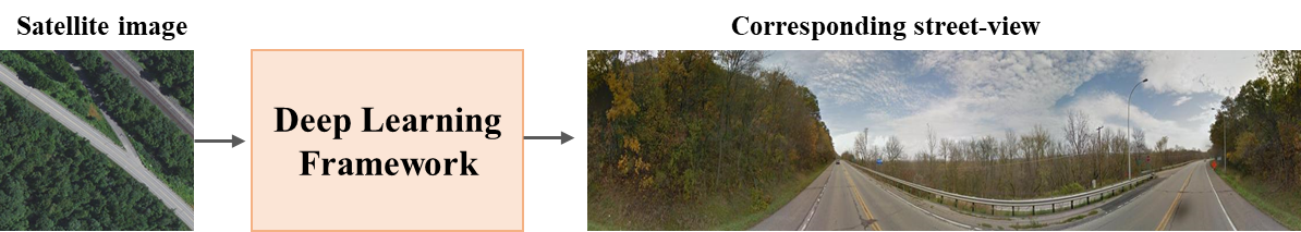
In recent years, street view imagery has grown to become one of the most important sources of geospatial data collection and urban analytics, which facilitates generating meaningful insights and assisting in decision-making. Synthesizing a street-view image from its corresponding satellite image is a challenging task due to the significant differences in appearance and viewpoint between the two domains. In this study, we screened 20 recent research papers to provide a thorough review of the state-of-the-art of how street-view images are synthesized from their corresponding satellite counterparts. The main findings are: (i) novel deep learning techniques are required for synthesizing more realistic and accurate street-view images; (ii) more datasets need to be collected for public usage; and (iii) more specific evaluation metrics need to be investigated for evaluating the generated images appropriately. We conclude that, due to applying outdated deep learning techniques, the recent literature failed to generate detailed and diverse street-view images.
5/16/2024
✨
OpenStreetView-5M: The Many Roads to Global Visual Geolocation
Guillaume Astruc, Nicolas Dufour, Ioannis Siglidis, Constantin Aronssohn, Nacim Bouia, Stephanie Fu, Romain Loiseau, Van Nguyen Nguyen, Charles Raude, Elliot Vincent, Lintao XU, Hongyu Zhou, Loic Landrieu
0
0
Determining the location of an image anywhere on Earth is a complex visual task, which makes it particularly relevant for evaluating computer vision algorithms. Yet, the absence of standard, large-scale, open-access datasets with reliably localizable images has limited its potential. To address this issue, we introduce OpenStreetView-5M, a large-scale, open-access dataset comprising over 5.1 million geo-referenced street view images, covering 225 countries and territories. In contrast to existing benchmarks, we enforce a strict train/test separation, allowing us to evaluate the relevance of learned geographical features beyond mere memorization. To demonstrate the utility of our dataset, we conduct an extensive benchmark of various state-of-the-art image encoders, spatial representations, and training strategies. All associated codes and models can be found at https://github.com/gastruc/osv5m.
4/30/2024

Eyes on the Streets: Leveraging Street-Level Imaging to Model Urban Crime Dynamics
Zhixuan Qi, Huaiying Luo, Chen Chi
0
0
This study addresses the challenge of urban safety in New York City by examining the relationship between the built environment and crime rates using machine learning and a comprehensive dataset of street view im- ages. We aim to identify how urban landscapes correlate with crime statistics, focusing on the characteristics of street views and their association with crime rates. The findings offer insights for urban planning and crime pre- vention, highlighting the potential of environmental de- sign in enhancing public safety.
4/17/2024

Survey on Datasets for Perception in Unstructured Outdoor Environments
Peter Mortimer, Mirko Maehlisch
0
0
Perception is an essential component of pipelines in field robotics. In this survey, we quantitatively compare publicly available datasets available in unstructured outdoor environments. We focus on datasets for common perception tasks in field robotics. Our survey categorizes and compares available research datasets. This survey also reports on relevant dataset characteristics to help practitioners determine which dataset fits best for their own application. We believe more consideration should be taken in choosing compatible annotation policies across the datasets in unstructured outdoor environments.
4/30/2024