QuickQuakeBuildings: Post-earthquake SAR-Optical Dataset for Quick Damaged-building Detection

0

Sign in to get full access
Introduction
The paper "QuickQuakeBuildings: Post-earthquake SAR-Optical Dataset for Quick Damaged-building Detection" presents a new dataset and approach for rapidly detecting damaged buildings after an earthquake using a combination of synthetic aperture radar (SAR) and optical remote sensing imagery.
Overview
- The researchers created a large-scale dataset of post-earthquake SAR and optical imagery, as well as building damage annotations, to train and evaluate machine learning models for quick damaged-building detection.
- The dataset covers several major earthquake events and large urban areas, providing a diverse and realistic testbed for this important application.
- The researchers demonstrate the effectiveness of convolutional neural networks (CNNs) in leveraging the complementary information from SAR and optical data to accurately identify damaged buildings.
- The dataset and code are publicly available to support further research and real-world deployment of these techniques.
Plain English Explanation
After a major earthquake, quickly identifying damaged buildings is crucial for coordinating emergency response, allocating resources, and assessing the extent of the disaster. This paper introduces a new dataset that combines satellite images from different sensors to help AI systems learn to automatically detect damaged buildings.
The researchers collected a large amount of data from several real-world earthquake events, including both radar-based (SAR) and regular (optical) satellite images of the affected areas. They also gathered information on which buildings were damaged, to use as ground truth for training the AI models.
By feeding this diverse dataset into convolutional neural networks (a type of AI model well-suited for processing visual data), the researchers showed that the models could effectively combine the unique information from the different imaging sensors to accurately identify damaged buildings. This is an important step towards developing systems that can rapidly assess earthquake damage and guide emergency response efforts.
The dataset and code are publicly available, so other researchers can build on this work and apply these techniques to real-world disaster response scenarios. This could help communities become more resilient in the face of natural disasters.
Technical Explanation
The researchers created the "QuickQuakeBuildings" dataset, which contains post-earthquake SAR and optical imagery, as well as building-level damage annotations, across several major earthquake events and large urban areas. This dataset provides a comprehensive testbed for developing and evaluating machine learning models for rapid damaged-building detection.
The key elements of the paper include:
- Data Collection: The dataset covers earthquake events in Italy, Taiwan, and the United States, capturing a range of building types, damage patterns, and sensor characteristics.
- Data Preprocessing: The researchers aligned the SAR and optical imagery, and applied various preprocessing techniques to enhance the relevant features for damage detection.
- Model Architecture: The researchers employed convolutional neural networks (CNNs) to leverage the complementary information in the SAR and optical data for accurate building damage classification.
- Experimental Evaluation: Thorough experiments demonstrate the effectiveness of the proposed approach, with the CNN model outperforming baseline methods by a significant margin.
The researchers also provide the dataset and code publicly to support further research and real-world deployment of these techniques for post-earthquake damage assessment.
Critical Analysis
The paper presents a comprehensive dataset and approach for rapid damaged-building detection, which is a crucial capability for effective disaster response. The large-scale, diverse nature of the dataset, and the demonstrated performance of the CNN models, are notable strengths of the research.
However, the paper does not delve into potential limitations or caveats of the proposed approach. For example, the performance of the models may be affected by factors such as image resolution, sensor characteristics, and the specific types of damage present. Additionally, the researchers do not address potential challenges in deploying these techniques in real-world scenarios, such as the need for near real-time processing or the integration with other disaster management systems.
Further research could explore the robustness of the models to varying conditions, as well as investigate ways to improve the efficiency and operational readiness of the damage assessment workflow. Incorporating additional contextual information, such as OpenStreetMap data, could also enhance the models' understanding of the built environment and improve their damage detection capabilities.
Conclusion
The "QuickQuakeBuildings" dataset and the demonstrated CNN-based approach for rapid damaged-building detection represent an important contribution to the field of remote sensing for disaster response. By leveraging the complementary information in SAR and optical imagery, the researchers have shown the potential for AI-powered systems to quickly assess earthquake damage and guide emergency efforts.
The public release of the dataset and code will foster further research and development in this area, ultimately helping communities become more resilient in the face of natural disasters. As the authors continue to address the limitations and challenges, the impact of this work could extend to a wide range of real-world applications for post-disaster assessment and management.
This summary was produced with help from an AI and may contain inaccuracies - check out the links to read the original source documents!
Related Papers
0
QuickQuakeBuildings: Post-earthquake SAR-Optical Dataset for Quick Damaged-building Detection
Yao Sun, Yi Wang, Michael Eineder
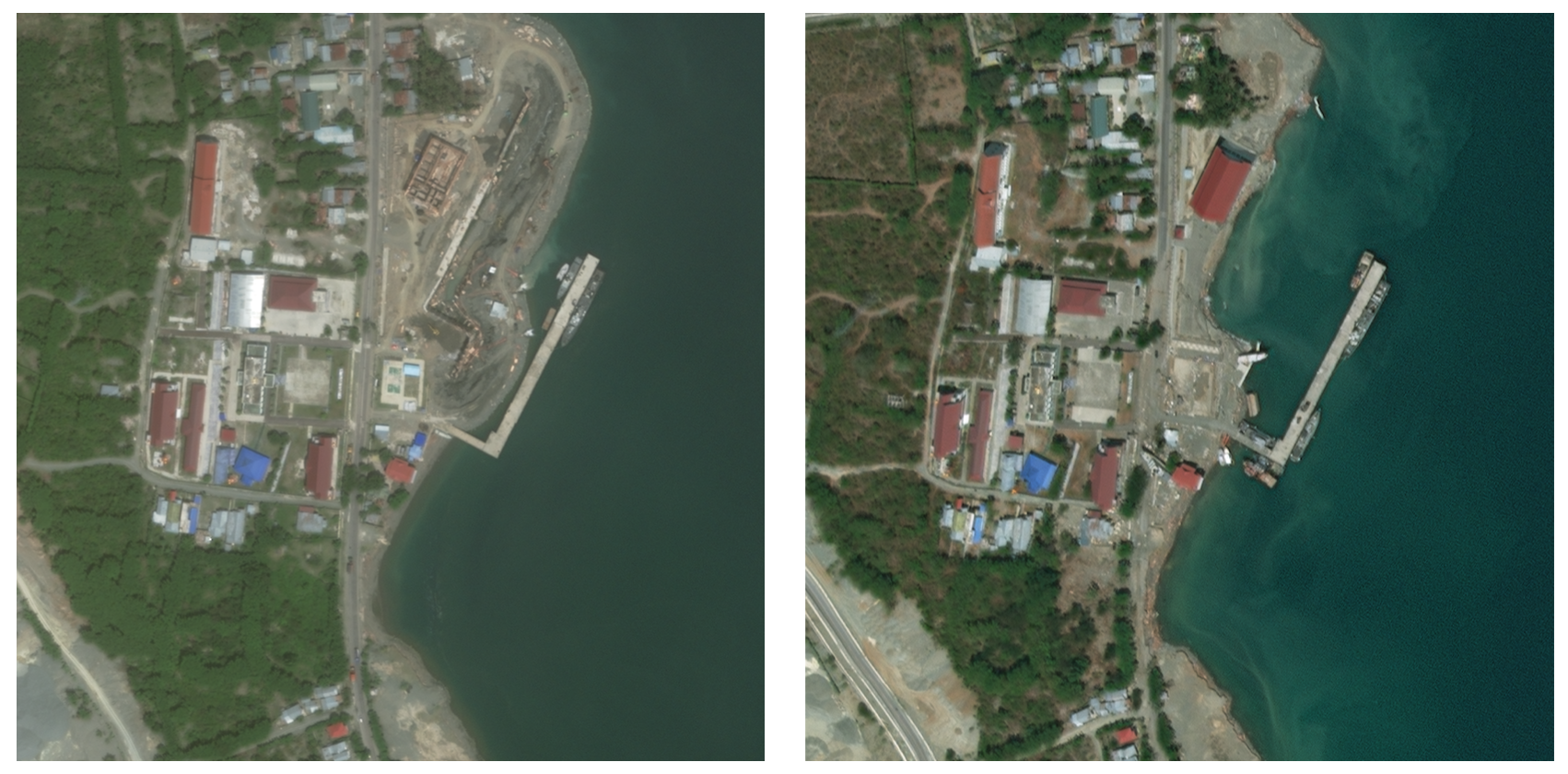
Quick and automated earthquake-damaged building detection from post-event satellite imagery is crucial, yet it is challenging due to the scarcity of training data required to develop robust algorithms. This letter presents the first dataset dedicated to detecting earthquake-damaged buildings from post-event very high resolution (VHR) Synthetic Aperture Radar (SAR) and optical imagery. Utilizing open satellite imagery and annotations acquired after the 2023 Turkey-Syria earthquakes, we deliver a dataset of coregistered building footprints and satellite image patches of both SAR and optical data, encompassing more than four thousand buildings. The task of damaged building detection is formulated as a binary image classification problem, that can also be treated as an anomaly detection problem due to extreme class imbalance. We provide baseline methods and results to serve as references for comparison. Researchers can utilize this dataset to expedite algorithm development, facilitating the rapid detection of damaged buildings in response to future events. The dataset and codes together with detailed explanations and visualization are made publicly available at url{https://github.com/ya0-sun/PostEQ-SARopt-BuildingDamage}.
Read more4/8/2024

0
An Open-Source Tool for Mapping War Destruction at Scale in Ukraine using Sentinel-1 Time Series
Olivier Dietrich, Torben Peters, Vivien Sainte Fare Garnot, Valerie Sticher, Thao Ton-That Whelan, Konrad Schindler, Jan Dirk Wegner
Access to detailed war impact assessments is crucial for humanitarian organizations to effectively assist populations most affected by armed conflicts. However, maintaining a comprehensive understanding of the situation on the ground is challenging, especially in conflicts that cover vast territories and extend over long periods. This study presents a scalable and transferable method for estimating war-induced damage to buildings. We first train a machine learning model to output pixel-wise probability of destruction from Synthetic Aperture Radar (SAR) satellite image time series, leveraging existing, manual damage assessments as ground truth and cloud-based geospatial analysis tools for large-scale inference. We further post-process these assessments using open building footprints to obtain a final damage estimate per building. We introduce an accessible, open-source tool that allows users to adjust the confidence interval based on their specific requirements and use cases. Our approach enables humanitarian organizations and other actors to rapidly screen large geographic regions for war impacts. We provide two publicly accessible dashboards: a Ukraine Damage Explorer to dynamically view our pre-computed estimates, and a Rapid Damage Mapping Tool to easily run our method and produce custom maps.
Read more6/5/2024
0
DeepDamageNet: A two-step deep-learning model for multi-disaster building damage segmentation and classification using satellite imagery
Irene Alisjahbana (Mullet), Jiawei Li (Mullet), Ben (Mullet), Strong, Yue Zhang
Satellite imagery has played an increasingly important role in post-disaster building damage assessment. Unfortunately, current methods still rely on manual visual interpretation, which is often time-consuming and can cause very low accuracy. To address the limitations of manual interpretation, there has been a significant increase in efforts to automate the process. We present a solution that performs the two most important tasks in building damage assessment, segmentation and classification, through deep-learning models. We show our results submitted as part of the xView2 Challenge, a competition to design better models for identifying buildings and their damage level after exposure to multiple kinds of natural disasters. Our best model couples a building identification semantic segmentation convolutional neural network (CNN) to a building damage classification CNN, with a combined F1 score of 0.66, surpassing the xView2 challenge baseline F1 score of 0.28. We find that though our model was able to identify buildings with relatively high accuracy, building damage classification across various disaster types is a difficult task due to the visual similarity between different damage levels and different damage distribution between disaster types, highlighting the fact that it may be important to have a probabilistic prior estimate regarding disaster damage in order to obtain accurate predictions.
Read more5/9/2024

0
CRASAR-U-DROIDs: A Large Scale Benchmark Dataset for Building Alignment and Damage Assessment in Georectified sUAS Imagery
Thomas Manzini, Priyankari Perali, Raisa Karnik, Robin Murphy
This document presents the Center for Robot Assisted Search And Rescue - Uncrewed Aerial Systems - Disaster Response Overhead Inspection Dataset (CRASAR-U-DROIDs) for building damage assessment and spatial alignment collected from small uncrewed aerial systems (sUAS) geospatial imagery. This dataset is motivated by the increasing use of sUAS in disaster response and the lack of previous work in utilizing high-resolution geospatial sUAS imagery for machine learning and computer vision models, the lack of alignment with operational use cases, and with hopes of enabling further investigations between sUAS and satellite imagery. The CRASAR-U-DRIODs dataset consists of fifty-two (52) orthomosaics from ten (10) federally declared disasters (Hurricane Ian, Hurricane Ida, Hurricane Harvey, Hurricane Idalia, Hurricane Laura, Hurricane Michael, Musset Bayou Fire, Mayfield Tornado, Kilauea Eruption, and Champlain Towers Collapse) spanning 67.98 square kilometers (26.245 square miles), containing 21,716 building polygons and damage labels, and 7,880 adjustment annotations. The imagery was tiled and presented in conjunction with overlaid building polygons to a pool of 130 annotators who provided human judgments of damage according to the Joint Damage Scale. These annotations were then reviewed via a two-stage review process in which building polygon damage labels were first reviewed individually and then again by committee. Additionally, the building polygons have been aligned spatially to precisely overlap with the imagery to enable more performant machine learning models to be trained. It appears that CRASAR-U-DRIODs is the largest labeled dataset of sUAS orthomosaic imagery.
Read more7/31/2024