SkyDiffusion: Street-to-Satellite Image Synthesis with Diffusion Models and BEV Paradigm

0

Sign in to get full access
Overview
- SkyDiffusion is a paper that explores using diffusion models and a birds-eye-view (BEV) approach to synthesize satellite images from street-level images.
- The key ideas are using diffusion models to generate high-quality satellite images from street-view inputs, and leveraging the BEV paradigm to bridge the gap between the two perspectives.
- The paper presents experimental results demonstrating the effectiveness of this approach for synthesizing realistic satellite imagery.
Plain English Explanation
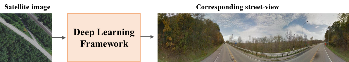
The paper introduces a new method called SkyDiffusion that can generate satellite images from street-level photographs. This is a challenging task, as the two types of images have very different perspectives and visual characteristics.
The core idea behind SkyDiffusion is to use diffusion models, a type of generative AI, to bridge the gap between street-level and satellite views. Diffusion models work by gradually adding noise to an image and then learning to reverse that process, allowing them to generate new images from scratch.
By combining diffusion models with a birds-eye-view (BEV) approach, the researchers were able to effectively translate between the street-level and satellite perspectives. The BEV paradigm provides a common coordinate system to align the two views, enabling the diffusion model to learn the mapping between them.
Through extensive experiments, the authors demonstrate that SkyDiffusion can synthesize highly realistic satellite imagery from street-level inputs. This has numerous potential applications, such as urban planning, infrastructure monitoring, and disaster response, where having up-to-date satellite data is crucial but can be challenging to obtain.
Technical Explanation
The key technical contributions of the SkyDiffusion paper are:
-
Diffusion Model Architecture: The authors develop a custom diffusion model architecture that is optimized for the task of street-to-satellite image synthesis. This includes adaptations to handle the different input and output modalities.
-
BEV Paradigm Integration: To bridge the gap between street-level and satellite perspectives, the researchers integrate a BEV representation into the diffusion model. This allows the model to learn the mapping between the two views more effectively.
-
Extensive Experimentation: The paper presents a comprehensive evaluation of the SkyDiffusion approach, including comparisons to baseline methods and ablation studies to understand the contributions of different components.
The experiments demonstrate that SkyDiffusion significantly outperforms previous methods for street-to-satellite image synthesis, producing highly realistic and accurate satellite imagery from street-level inputs.
Critical Analysis
The SkyDiffusion paper makes a compelling case for the potential of diffusion models and the BEV paradigm in bridging the gap between street-level and satellite imagery. However, the authors acknowledge several limitations and areas for future work:
- The current SkyDiffusion model is trained and evaluated on a single dataset, and its performance on more diverse or challenging real-world scenarios is unknown.
- The paper does not provide a detailed analysis of the model's failure cases or edge cases, which would be valuable for understanding its robustness and limitations.
- While the BEV representation is a key innovation, the authors do not explore alternative approaches for aligning the street-level and satellite perspectives.
- The computational and memory requirements of the diffusion model architecture are not discussed, which could be an important practical consideration for deployment.
Future research could address these limitations by expanding the evaluation, providing more in-depth analysis, and exploring alternative architectural designs or alignment strategies.
Conclusion
The SkyDiffusion paper presents a novel approach to street-to-satellite image synthesis that leverages the power of diffusion models and the BEV paradigm. The experimental results demonstrate the effectiveness of this method in generating high-quality satellite imagery from street-level inputs, with potential applications in urban planning, infrastructure monitoring, and disaster response.
While the paper highlights several promising directions, there are also opportunities for further research to address the identified limitations and explore the broader implications of this technology. As the field of generative AI continues to advance, methods like SkyDiffusion could play a crucial role in bridging the gap between diverse data sources and enabling more comprehensive and accurate understanding of the world around us.
This summary was produced with help from an AI and may contain inaccuracies - check out the links to read the original source documents!
Related Papers
0
SkyDiffusion: Street-to-Satellite Image Synthesis with Diffusion Models and BEV Paradigm
Junyan Ye, Jun He, Weijia Li, Zhutao Lv, Jinhua Yu, Haote Yang, Conghui He
Street-to-satellite image synthesis focuses on generating realistic satellite images from corresponding ground street-view images while maintaining a consistent content layout, similar to looking down from the sky. The significant differences in perspectives create a substantial domain gap between the views, making this cross-view generation task particularly challenging. In this paper, we introduce SkyDiffusion, a novel cross-view generation method for synthesizing satellite images from street-view images, leveraging diffusion models and Bird's Eye View (BEV) paradigm. First, we design a Curved-BEV method to transform street-view images to the satellite view, reformulating the challenging cross-domain image synthesis task into a conditional generation problem. Curved-BEV also includes a Multi-to-One mapping strategy for leveraging multiple street-view images within the same satellite coverage area, effectively solving the occlusion issues in dense urban scenes. Next, we design a BEV-controlled diffusion model to generate satellite images consistent with the street-view content, which also incorporates a light manipulation module to make the lighting conditions of the synthesized satellite images more flexible. Experimental results demonstrate that SkyDiffusion outperforms state-of-the-art methods on both suburban (CVUSA & CVACT) and urban (VIGOR-Chicago) cross-view datasets, with an average SSIM increase of 13.96% and a FID reduction of 20.54%, achieving realistic and content-consistent satellite image generation. The code and models of this work will be released at https://opendatalab.github.io/skydiffusion
Read more8/20/2024

0
CrossViewDiff: A Cross-View Diffusion Model for Satellite-to-Street View Synthesis
Weijia Li, Jun He, Junyan Ye, Huaping Zhong, Zhimeng Zheng, Zilong Huang, Dahua Lin, Conghui He
Satellite-to-street view synthesis aims at generating a realistic street-view image from its corresponding satellite-view image. Although stable diffusion models have exhibit remarkable performance in a variety of image generation applications, their reliance on similar-view inputs to control the generated structure or texture restricts their application to the challenging cross-view synthesis task. In this work, we propose CrossViewDiff, a cross-view diffusion model for satellite-to-street view synthesis. To address the challenges posed by the large discrepancy across views, we design the satellite scene structure estimation and cross-view texture mapping modules to construct the structural and textural controls for street-view image synthesis. We further design a cross-view control guided denoising process that incorporates the above controls via an enhanced cross-view attention module. To achieve a more comprehensive evaluation of the synthesis results, we additionally design a GPT-based scoring method as a supplement to standard evaluation metrics. We also explore the effect of different data sources (e.g., text, maps, building heights, and multi-temporal satellite imagery) on this task. Results on three public cross-view datasets show that CrossViewDiff outperforms current state-of-the-art on both standard and GPT-based evaluation metrics, generating high-quality street-view panoramas with more realistic structures and textures across rural, suburban, and urban scenes. The code and models of this work will be released at https://opendatalab.github.io/CrossViewDiff/.
Read more8/28/2024

0
From Bird's-Eye to Street View: Crafting Diverse and Condition-Aligned Images with Latent Diffusion Model
Xiaojie Xu, Tianshuo Xu, Fulong Ma, Yingcong Chen
We explore Bird's-Eye View (BEV) generation, converting a BEV map into its corresponding multi-view street images. Valued for its unified spatial representation aiding multi-sensor fusion, BEV is pivotal for various autonomous driving applications. Creating accurate street-view images from BEV maps is essential for portraying complex traffic scenarios and enhancing driving algorithms. Concurrently, diffusion-based conditional image generation models have demonstrated remarkable outcomes, adept at producing diverse, high-quality, and condition-aligned results. Nonetheless, the training of these models demands substantial data and computational resources. Hence, exploring methods to fine-tune these advanced models, like Stable Diffusion, for specific conditional generation tasks emerges as a promising avenue. In this paper, we introduce a practical framework for generating images from a BEV layout. Our approach comprises two main components: the Neural View Transformation and the Street Image Generation. The Neural View Transformation phase converts the BEV map into aligned multi-view semantic segmentation maps by learning the shape correspondence between the BEV and perspective views. Subsequently, the Street Image Generation phase utilizes these segmentations as a condition to guide a fine-tuned latent diffusion model. This finetuning process ensures both view and style consistency. Our model leverages the generative capacity of large pretrained diffusion models within traffic contexts, effectively yielding diverse and condition-coherent street view images.
Read more9/4/2024
0
Bird's-Eye View to Street-View: A Survey
Khawlah Bajbaa, Muhammad Usman, Saeed Anwar, Ibrahim Radwan, Abdul Bais
In recent years, street view imagery has grown to become one of the most important sources of geospatial data collection and urban analytics, which facilitates generating meaningful insights and assisting in decision-making. Synthesizing a street-view image from its corresponding satellite image is a challenging task due to the significant differences in appearance and viewpoint between the two domains. In this study, we screened 20 recent research papers to provide a thorough review of the state-of-the-art of how street-view images are synthesized from their corresponding satellite counterparts. The main findings are: (i) novel deep learning techniques are required for synthesizing more realistic and accurate street-view images; (ii) more datasets need to be collected for public usage; and (iii) more specific evaluation metrics need to be investigated for evaluating the generated images appropriately. We conclude that, due to applying outdated deep learning techniques, the recent literature failed to generate detailed and diverse street-view images.
Read more5/16/2024