Swarm-LIO2: Decentralized, Efficient LiDAR-inertial Odometry for UAV Swarms

0

Sign in to get full access
Overview
- The paper introduces Swarm-LIO2, a decentralized and efficient LiDAR-inertial odometry system for UAV swarms.
- It addresses the challenges of achieving accurate, real-time localization in GPS-denied environments using a distributed, low-power approach.
- The system leverages LiDAR and inertial measurement unit (IMU) data to estimate the 6-DOF pose of individual UAVs in a swarm.
- A key innovation is the use of a decentralized extended Kalman filter (EKF) to fuse the sensor data and maintain consistent state estimates across the swarm.
Plain English Explanation
Swarm-LIO2 is a new navigation system designed for groups of drones or UAVs (unmanned aerial vehicles) that need to know their exact location and orientation, even in areas where GPS signals are blocked or unavailable.
The system uses two key sensors:
- LiDAR: A laser-based scanner that creates a 3D map of the surroundings.
- IMU: An "inertial measurement unit" that tracks the drone's movements using accelerometers and gyroscopes.
By combining the data from these sensors, Swarm-LIO2 can continuously estimate the 6-dimensional pose (position and orientation) of each drone in the swarm. Importantly, this is done in a decentralized way, meaning each drone handles its own calculations rather than relying on a central control station.
The decentralized approach makes the system more efficient and resilient, as the drones can continue operating even if some units fail or lose communication. Swarm-LIO2 also uses an extended Kalman filter to fuse the sensor data and maintain consistent state estimates across the swarm.
Overall, Swarm-LIO2 provides a robust and scalable solution for drone swarm navigation in challenging, GPS-denied environments, with potential applications in areas like search and rescue, surveillance, and autonomous logistics.
Technical Explanation
The core innovation in Swarm-LIO2 is its decentralized architecture, which allows each UAV to independently estimate its own 6-DOF pose (position and orientation) using LiDAR and IMU data. This is achieved through a decentralized extended Kalman filter (EKF) that fuses the sensor measurements.
The EKF maintains a local state estimate for each UAV, which includes its position, orientation, velocity, and various sensor biases. As the UAVs move, they continuously update their state estimates by incorporating new LiDAR scans and IMU readings. The decentralized nature of the system means these updates happen independently on each drone, without the need for a central coordinator.
To ensure consistency across the swarm, the UAVs periodically exchange their current state estimates with their neighbors. This allows each drone to maintain an up-to-date map of the relative poses of all the other UAVs in the swarm. The authors demonstrate that this distributed approach is both efficient and resilient, as the loss of a single drone or communication link does not significantly impact the overall system performance.
Swarm-LIO2 also includes several optimizations to improve computational efficiency and reduce power consumption, such as adaptive downsampling of the LiDAR point clouds and selective sensor updates. These techniques allow the system to run in real-time on the limited onboard hardware of small UAVs.
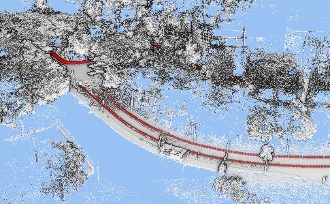
The paper presents extensive experimental evaluations, including both simulated and real-world tests, that validate the accuracy and robustness of Swarm-LIO2 for UAV swarm navigation in GPS-denied environments.
Critical Analysis
The researchers have done a commendable job in addressing the key challenges of decentralized, low-power LiDAR-inertial odometry for UAV swarms. Some potential areas for further improvement or investigation include:
-
Handling Sensor Failures: While the authors mention the resilience of the decentralized approach, it would be interesting to see a more detailed analysis of how the system handles the loss or degradation of individual sensors (e.g., LiDAR or IMU) on one or more UAVs within the swarm.
-
Scalability Limits: The paper demonstrates results for swarms of up to 10 UAVs. It would be valuable to understand the scalability limits of the approach as the swarm size increases, both in terms of computational load and communication overhead.
-
Optimization for Heterogeneous Hardware: The current implementation assumes homogeneous hardware across the swarm. Exploring techniques to adapt the system for UAVs with varying computational resources could broaden the applicability of Swarm-LIO2.
-
Cooperative Mapping and Exploration: The decentralized nature of Swarm-LIO2 suggests potential for cooperative mapping and exploration strategies, where the UAVs could work together to build a more comprehensive understanding of their environment. Investigating such capabilities could be an interesting direction for future research.
Overall, Swarm-LIO2 represents a significant advancement in the field of decentralized, energy-efficient localization for UAV swarms, with promising real-world applications in GPS-denied environments.
Conclusion
The Swarm-LIO2 system introduces a novel approach to LiDAR-inertial odometry for UAV swarms, addressing the key challenges of achieving accurate, real-time localization in a decentralized, low-power manner. By leveraging a distributed extended Kalman filter to fuse sensor data from each UAV, the system maintains consistent state estimates across the swarm without the need for a central coordinator.
The decentralized architecture of Swarm-LIO2 makes it resilient to individual sensor or drone failures, while various optimizations ensure efficient operation on the limited onboard resources of small UAVs. The comprehensive experimental evaluation, including both simulated and real-world tests, demonstrates the accuracy and robustness of the system for UAV swarm navigation in GPS-denied environments.
Overall, Swarm-LIO2 represents an important advancement in the field of collaborative drone navigation, with potential applications in search and rescue, surveillance, and autonomous logistics, among others. The research also highlights the value of decentralized approaches for enhancing the scalability and resilience of multi-agent robotic systems.
This summary was produced with help from an AI and may contain inaccuracies - check out the links to read the original source documents!
Related Papers
0
Swarm-LIO2: Decentralized, Efficient LiDAR-inertial Odometry for UAV Swarms
Fangcheng Zhu, Yunfan Ren, Longji Yin, Fanze Kong, Qingbo Liu, Ruize Xue, Wenyi Liu, Yixi Cai, Guozheng Lu, Haotian Li, Fu Zhang
Aerial swarm systems possess immense potential in various aspects, such as cooperative exploration, target tracking, search and rescue. Efficient, accurate self and mutual state estimation are the critical preconditions for completing these swarm tasks, which remain challenging research topics. This paper proposes Swarm-LIO2: a fully decentralized, plug-and-play, computationally efficient, and bandwidth-efficient LiDAR-inertial odometry for aerial swarm systems. Swarm-LIO2 uses a decentralized, plug-and-play network as the communication infrastructure. Only bandwidth-efficient and low-dimensional information is exchanged, including identity, ego-state, mutual observation measurements, and global extrinsic transformations. To support the plug-and-play of new teammate participants, Swarm-LIO2 detects potential teammate UAVs and initializes the temporal offset and global extrinsic transformation all automatically. To enhance the initialization efficiency, novel reflectivity-based UAV detection, trajectory matching, and factor graph optimization methods are proposed. For state estimation, Swarm-LIO2 fuses LiDAR, IMU, and mutual observation measurements within an efficient ESIKF framework, with careful compensation of temporal delay and modeling of measurements to enhance the accuracy and consistency.
Read more9/27/2024

0
LOG-LIO2: A LiDAR-Inertial Odometry with Efficient Uncertainty Analysis
Kai Huang, Junqiao Zhao, Jiaye Lin, Zhongyang Zhu, Shuangfu Song, Chen Ye, Tiantian Feng
Uncertainty in LiDAR measurements, stemming from factors such as range sensing, is crucial for LIO (LiDAR-Inertial Odometry) systems as it affects the accurate weighting in the loss function. While recent LIO systems address uncertainty related to range sensing, the impact of incident angle on uncertainty is often overlooked by the community. Moreover, the existing uncertainty propagation methods suffer from computational inefficiency. This paper proposes a comprehensive point uncertainty model that accounts for both the uncertainties from LiDAR measurements and surface characteristics, along with an efficient local uncertainty analytical method for LiDAR-based state estimation problem. We employ a projection operator that separates the uncertainty into the ray direction and its orthogonal plane. Then, we derive incremental Jacobian matrices of eigenvalues and eigenvectors w.r.t. points, which enables a fast approximation of uncertainty propagation. This approach eliminates the requirement for redundant traversal of points, significantly reducing the time complexity of uncertainty propagation from $mathcal{O} (n)$ to $mathcal{O} (1)$ when a new point is added. Simulations and experiments on public datasets are conducted to validate the accuracy and efficiency of our formulations. The proposed methods have been integrated into a LIO system, which is available at https://github.com/tiev-tongji/LOG-LIO2.
Read more5/3/2024
💬
0
LIO-EKF: High Frequency LiDAR-Inertial Odometry using Extended Kalman Filters
Yibin Wu, Tiziano Guadagnino, Louis Wiesmann, Lasse Klingbeil, Cyrill Stachniss, Heiner Kuhlmann
Odometry estimation is crucial for every autonomous system requiring navigation in an unknown environment. In modern mobile robots, 3D LiDAR-inertial systems are often used for this task. By fusing LiDAR scans and IMU measurements, these systems can reduce the accumulated drift caused by sequentially registering individual LiDAR scans and provide a robust pose estimate. Although effective, LiDAR-inertial odometry systems require proper parameter tuning to be deployed. In this paper, we propose LIO-EKF, a tightly-coupled LiDAR-inertial odometry system based on point-to-point registration and the classical extended Kalman filter scheme. We propose an adaptive data association that considers the relative pose uncertainty, the map discretization errors, and the LiDAR noise. In this way, we can substantially reduce the parameters to tune for a given type of environment. The experimental evaluation suggests that the proposed system performs on par with the state-of-the-art LiDAR-inertial odometry pipelines but is significantly faster in computing the odometry. The source code of our implementation is publicly available (https://github.com/YibinWu/LIO-EKF).
Read more5/9/2024
0
Eigen Is All You Need: Efficient Lidar-Inertial Continuous-Time Odometry with Internal Association
Thien-Minh Nguyen, Xinhang Xu, Tongxing Jin, Yizhuo Yang, Jianping Li, Shenghai Yuan, Lihua Xie
In this paper, we propose a continuous-time lidar-inertial odometry (CT-LIO) system named SLICT2, which promotes two main insights. One, contrary to conventional wisdom, CT-LIO algorithm can be optimized by linear solvers in only a few iterations, which is more efficient than commonly used nonlinear solvers. Two, CT-LIO benefits more from the correct association than the number of iterations. Based on these ideas, we implement our method with a customized solver where the feature association process is performed immediately after each incremental step, and the solution can converge within a few iterations. Our implementation can achieve real-time performance with a high density of control points while yielding competitive performance in highly dynamical motion scenarios. We demonstrate the advantages of our method by comparing with other existing state-of-the-art CT-LIO methods. The source code will be released for the benefit of the community.
Read more6/10/2024