Deep Learning Meets Satellite Images -- An Evaluation on Handcrafted and Learning-based Features for Multi-date Satellite Stereo Images

0

Sign in to get full access
Overview
- This paper evaluates the use of handcrafted and learning-based features for multi-date satellite stereo images.
- The authors compare the performance of traditional feature matching approaches with deep learning-based methods.
- Experiments are conducted on a challenging dataset of multi-temporal satellite image pairs.
Plain English Explanation
Satellite images are often taken at different times, which can make it difficult to match features between them. This is an important task for applications like 3D reconstruction from stereo imagery. The authors of this paper investigate two main approaches for addressing this challenge:
-
Handcrafted features: Traditional computer vision techniques that manually define distinctive image patterns or "features" that can be matched across images.
-
Learning-based features: Modern deep learning models that can automatically learn effective feature representations directly from image data.
The researchers evaluate the performance of these different feature matching methods on a dataset of satellite image pairs captured at different dates. They assess factors like the accuracy of 3D reconstruction and the robustness to changes in viewpoint, illumination, and other nuisance variables.
The findings provide insights into the strengths and limitations of each approach, helping to guide the selection of appropriate techniques for satellite image analysis tasks. Overall, the paper explores an important problem at the intersection of computer vision, remote sensing, and deep learning.
Technical Explanation
The paper begins by highlighting the importance of multi-date satellite stereo matching for applications like terrain mapping, change detection, and 3D reconstruction. However, this task is challenging due to factors like varying illumination, vegetation growth, and seasonal changes that can affect the appearance of the same scene across different image acquisitions.
To address this, the authors evaluate and compare the performance of traditional handcrafted feature descriptors (e.g., SIFT, SURF) with deep learning-based feature extractors (e.g., SuperPoint, D2-Net) on a dataset of multi-temporal satellite image pairs. They assess the accuracy of 3D point clouds reconstructed from the matched feature correspondences and analyze the robustness of each approach to various nuisance variables.
The experiments reveal that deep learning-based features generally outperform handcrafted features, achieving higher 3D reconstruction accuracy and being more resilient to appearance changes. However, the authors also note that the performance gap can vary depending on factors like training data availability and the specific characteristics of the satellite imagery.
Additionally, the paper discusses practical considerations such as the computational efficiency and scalability of the different feature matching techniques. It also highlights areas for future research, including the potential for hybrid approaches that combine the strengths of both handcrafted and learning-based features.
Critical Analysis
The paper provides a thorough and well-designed comparison of feature matching techniques for multi-date satellite imagery, which is an important problem in the field of remote sensing and 3D reconstruction. The authors have carefully selected a diverse set of feature descriptors, both traditional and deep learning-based, and evaluated their performance on a challenging dataset.
One potential limitation of the study is the use of a single dataset, which may limit the generalizability of the findings. It would be valuable to see similar experiments conducted on a broader range of satellite imagery, including data from different sensors, geographic regions, and application domains.
Additionally, while the paper discusses the computational efficiency of the different approaches, it would be informative to include more detailed benchmarking of the runtime and memory requirements, especially for real-world deployment scenarios.
The authors also acknowledge that the performance of learning-based features can be heavily dependent on the availability and quality of training data. Future research could explore data augmentation techniques or transfer learning strategies to improve the robustness of deep learning models in the absence of large-scale annotated datasets.
Overall, this paper makes a valuable contribution to the understanding of feature matching for multi-date satellite imagery and provides a solid foundation for further research in this area.
Conclusion
This paper presents a comprehensive evaluation of handcrafted and learning-based feature matching techniques for multi-temporal satellite stereo images. The results demonstrate the advantages of deep learning-based features in terms of 3D reconstruction accuracy and robustness to appearance changes, while also highlighting practical considerations such as computational efficiency and the need for diverse training data.
The findings from this study can help guide the selection of appropriate feature matching approaches for a wide range of satellite image analysis tasks, ultimately contributing to the advancement of remote sensing and 3D reconstruction technologies. Furthermore, the insights gained from this work can inform future research directions, such as exploring hybrid techniques or developing more effective data augmentation strategies for learning-based models.
This summary was produced with help from an AI and may contain inaccuracies - check out the links to read the original source documents!
Related Papers
0
Deep Learning Meets Satellite Images -- An Evaluation on Handcrafted and Learning-based Features for Multi-date Satellite Stereo Images
Shuang Song, Luca Morelli, Xinyi Wu, Rongjun Qin, Hessah Albanwan, Fabio Remondino
A critical step in the digital surface models(DSM) generation is feature matching. Off-track (or multi-date) satellite stereo images, in particular, can challenge the performance of feature matching due to spectral distortions between images, long baseline, and wide intersection angles. Feature matching methods have evolved over the years from handcrafted methods (e.g., SIFT) to learning-based methods (e.g., SuperPoint and SuperGlue). In this paper, we compare the performance of different features, also known as feature extraction and matching methods, applied to satellite imagery. A wide range of stereo pairs(~500) covering two separate study sites are used. SIFT, as a widely used classic feature extraction and matching algorithm, is compared with seven deep-learning matching methods: SuperGlue, LightGlue, LoFTR, ASpanFormer, DKM, GIM-LightGlue, and GIM-DKM. Results demonstrate that traditional matching methods are still competitive in this age of deep learning, although for particular scenarios learning-based methods are very promising.
Read more9/5/2024
✨
0
Comparative Analysis of Advanced Feature Matching Algorithms in Challenging High Spatial Resolution Optical Satellite Stereo Scenarios
Qiyan Luo, Jidan Zhang, Yuzhen Xie, Xu Huang, Ting Han
Feature matching determines the orientation accuracy for the High Spatial Resolution (HSR) optical satellite stereos, subsequently impacting several significant applications such as 3D reconstruction and change detection. However, the matching of off-track HSR optical satellite stereos often encounters challenging conditions including wide-baseline observation, significant radiometric differences, multi-temporal changes, varying spatial resolutions, inconsistent spectral resolution, and diverse sensors. In this study, we evaluate various advanced feature matching algorithms for HSR optical satellite stereos. Utilizing a specially constructed dataset from five satellites across six challenging scenarios, HSROSS Dataset, we conduct a comparative analysis of four algorithms: the traditional SIFT, and deep-learning based methods including SuperPoint + SuperGlue, SuperPoint + LightGlue, and LoFTR. Our findings highlight overall superior performance of SuperPoint + LightGlue in balancing robustness, accuracy, distribution, and efficiency, showcasing its potential in complex HSR optical satellite scenarios.
Read more5/13/2024

0
A Semantic Segmentation-guided Approach for Ground-to-Aerial Image Matching
Francesco Pro, Nikolaos Dionelis, Luca Maiano, Bertrand Le Saux, Irene Amerini
Nowadays the accurate geo-localization of ground-view images has an important role across domains as diverse as journalism, forensics analysis, transports, and Earth Observation. This work addresses the problem of matching a query ground-view image with the corresponding satellite image without GPS data. This is done by comparing the features from a ground-view image and a satellite one, innovatively leveraging the corresponding latter's segmentation mask through a three-stream Siamese-like network. The proposed method, Semantic Align Net (SAN), focuses on limited Field-of-View (FoV) and ground panorama images (images with a FoV of 360{deg}). The novelty lies in the fusion of satellite images in combination with their semantic segmentation masks, aimed at ensuring that the model can extract useful features and focus on the significant parts of the images. This work shows how SAN through semantic analysis of images improves the performance on the unlabelled CVUSA dataset for all the tested FoVs.
Read more5/24/2024
0
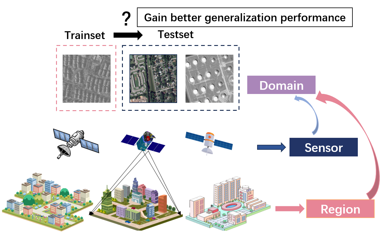
Rethinking the Key Factors for the Generalization of Remote Sensing Stereo Matching Networks
Liting Jiang, Feng Wang, Wenyi Zhang, Peifeng Li, Hongjian You, Yuming Xiang
Stereo matching, a critical step of 3D reconstruction, has fully shifted towards deep learning due to its strong feature representation of remote sensing images. However, ground truth for stereo matching task relies on expensive airborne LiDAR data, thus making it difficult to obtain enough samples for supervised learning. To improve the generalization ability of stereo matching networks on cross-domain data from different sensors and scenarios, in this paper, we dedicate to study key training factors from three perspectives. (1) For the selection of training dataset, it is important to select data with similar regional target distribution as the test set instead of utilizing data from the same sensor. (2) For model structure, cascaded structure that flexibly adapts to different sizes of features is preferred. (3) For training manner, unsupervised methods generalize better than supervised methods, and we design an unsupervised early-stop strategy to help retain the best model with pre-trained weights as the basis. Extensive experiments are conducted to support the previous findings, on the basis of which we present an unsupervised stereo matching network with good generalization performance. We release the source code and the datasets at https://github.com/Elenairene/RKF_RSSM to reproduce the results and encourage future work.
Read more8/15/2024