Geospecific View Generation -- Geometry-Context Aware High-resolution Ground View Inference from Satellite Views

0

Sign in to get full access
Overview
- This paper presents a novel approach for generating high-resolution ground-level views from satellite imagery, using a geometry-context aware deep learning model.
- The key idea is to leverage the structural and contextual information present in satellite views to infer the corresponding ground-level scene, enabling applications like cross-view geo-localization and semantic segmentation.
- The model is trained on a large-scale dataset of paired satellite and ground-level imagery, and can generate visually realistic and semantically consistent ground-level views.
Plain English Explanation
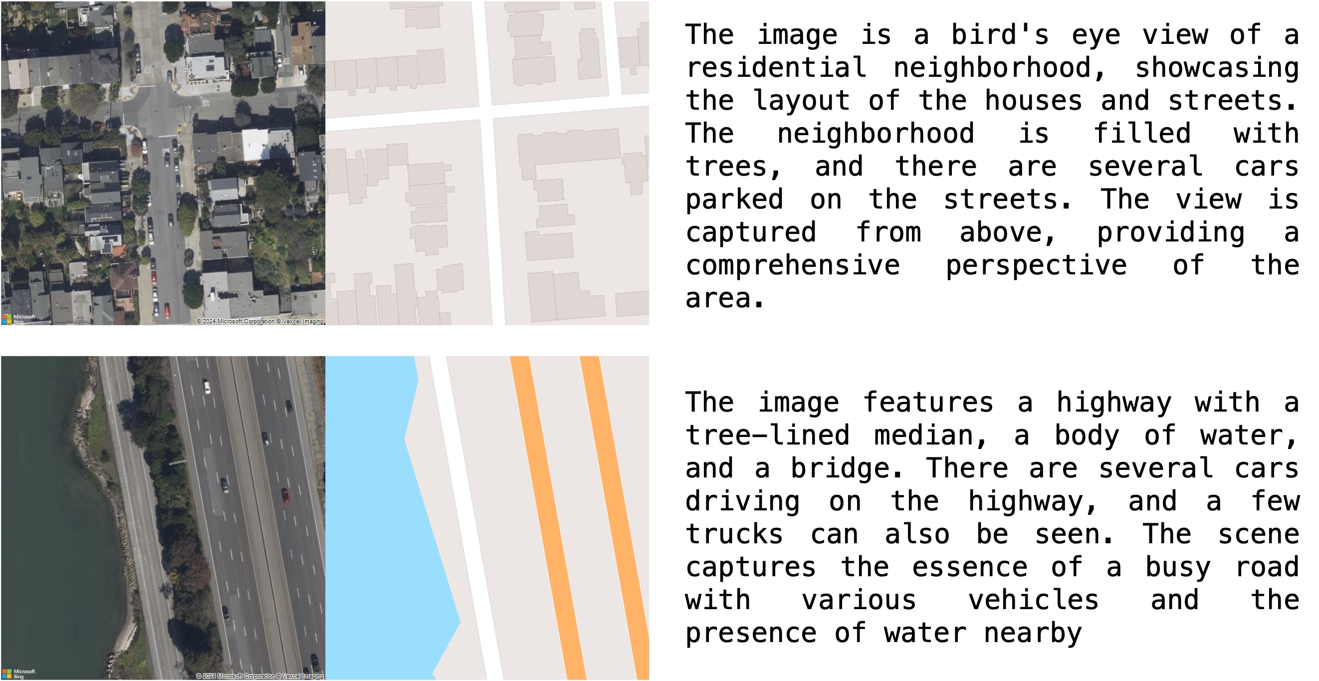
The paper tackles the challenge of generating detailed ground-level views from satellite imagery. This is a useful capability for various applications, such as helping users locate specific places on the ground by starting from a satellite view, or performing semantic segmentation to understand the contents of a scene.
The key insight is that satellite views contain a lot of structural and contextual information that can be leveraged to infer the corresponding ground-level scene. For example, the shapes and arrangements of buildings, roads, and other features in the satellite view provide important cues about what the ground-level view might look like.
The researchers developed a deep learning model that is trained on a large dataset of paired satellite and ground-level imagery. This allows the model to learn the geometric and contextual relationships between the two views. Once trained, the model can take a new satellite image as input and generate a realistic-looking ground-level view that is consistent with the satellite information.
This approach offers several advantages over previous methods that tried to generate ground-level views directly from satellite data. By incorporating the geometric and contextual knowledge from the satellite view, the generated ground-level images are more visually accurate and semantically meaningful.
Technical Explanation
The paper presents a geometry-context aware deep learning model for generating high-resolution ground-level views from satellite imagery. The model is trained on a large dataset of paired satellite and ground-level images, allowing it to learn the underlying geometric and contextual relationships between the two views.
The key components of the model include:
- Satellite Encoder: A convolutional neural network that encodes the satellite view into a compact feature representation, capturing the structural and contextual information.
- Geometry Estimator: A network module that predicts the 3D geometry of the scene, such as the heights and orientations of buildings, from the satellite features.
- Ground-level Generator: A generative adversarial network (GAN) that uses the satellite features and predicted 3D geometry to synthesize a high-resolution ground-level view that is visually realistic and semantically consistent with the input satellite image.
During training, the model learns to minimize a combination of reconstruction loss, adversarial loss, and geometry consistency loss to ensure the generated ground-level views are faithful to both the input satellite data and the real ground-level images.
The researchers evaluated their approach on several benchmark datasets, demonstrating its superiority over previous methods in terms of visual quality, semantic consistency, and quantitative metrics. The model was also shown to generalize well to diverse geographic locations and scene types.
Critical Analysis
The paper presents a compelling approach for generating high-quality ground-level views from satellite imagery, with several promising applications in areas like cross-view geo-localization and semantic segmentation. The key strength of the proposed method is its ability to leverage the geometric and contextual information present in satellite views to produce visually realistic and semantically coherent ground-level scenes.
However, the paper also acknowledges several limitations and areas for future work. For instance, the model's performance may be sensitive to the quality and diversity of the training data, and its ability to generalize to unseen or unusual environments is not fully explored. Additionally, the computational complexity of the model could be a concern for real-time or resource-constrained applications.
Another potential issue is the inherent uncertainty in inferring ground-level details from satellite data. While the model produces plausible results, there may be cases where the generated ground-level view deviates significantly from the actual scene, particularly in areas with complex 3D structures or occlusions. Further research may be needed to quantify and address these uncertainties.
Overall, the paper presents a compelling approach that advances the state-of-the-art in cross-view synthesis and satellite-based scene understanding. However, as with any research, there are opportunities for further refinement and exploration to address the identified limitations and expand the capabilities of the proposed system.
Conclusion
This paper introduces a novel deep learning-based approach for generating high-resolution ground-level views from satellite imagery, leveraging the geometric and contextual information present in the satellite data. The proposed model demonstrates impressive results in terms of visual quality, semantic consistency, and generalization, with potential applications in areas like cross-view geo-localization and semantic segmentation.
While the paper identifies several limitations and areas for future work, the core idea of bridging the gap between satellite and ground-level views using deep learning represents a significant advancement in the field of cross-view synthesis and satellite-based scene understanding. As the technology continues to evolve, it could enable a wide range of practical applications, from urban planning to navigation and beyond.
This summary was produced with help from an AI and may contain inaccuracies - check out the links to read the original source documents!
Related Papers
0
Geospecific View Generation -- Geometry-Context Aware High-resolution Ground View Inference from Satellite Views
Ningli Xu, Rongjun Qin
Predicting realistic ground views from satellite imagery in urban scenes is a challenging task due to the significant view gaps between satellite and ground-view images. We propose a novel pipeline to tackle this challenge, by generating geospecifc views that maximally respect the weak geometry and texture from multi-view satellite images. Different from existing approaches that hallucinate images from cues such as partial semantics or geometry from overhead satellite images, our method directly predicts ground-view images at geolocation by using a comprehensive set of information from the satellite image, resulting in ground-level images with a resolution boost at a factor of ten or more. We leverage a novel building refinement method to reduce geometric distortions in satellite data at ground level, which ensures the creation of accurate conditions for view synthesis using diffusion networks. Moreover, we proposed a novel geospecific prior, which prompts distribution learning of diffusion models to respect image samples that are closer to the geolocation of the predicted images. We demonstrate our pipeline is the first to generate close-to-real and geospecific ground views merely based on satellite images.
Read more9/16/2024
0
GeoSynth: Contextually-Aware High-Resolution Satellite Image Synthesis
Srikumar Sastry, Subash Khanal, Aayush Dhakal, Nathan Jacobs
We present GeoSynth, a model for synthesizing satellite images with global style and image-driven layout control. The global style control is via textual prompts or geographic location. These enable the specification of scene semantics or regional appearance respectively, and can be used together. We train our model on a large dataset of paired satellite imagery, with automatically generated captions, and OpenStreetMap data. We evaluate various combinations of control inputs, including different types of layout controls. Results demonstrate that our model can generate diverse, high-quality images and exhibits excellent zero-shot generalization. The code and model checkpoints are available at https://github.com/mvrl/GeoSynth.
Read more4/11/2024

0
A Semantic Segmentation-guided Approach for Ground-to-Aerial Image Matching
Francesco Pro, Nikolaos Dionelis, Luca Maiano, Bertrand Le Saux, Irene Amerini
Nowadays the accurate geo-localization of ground-view images has an important role across domains as diverse as journalism, forensics analysis, transports, and Earth Observation. This work addresses the problem of matching a query ground-view image with the corresponding satellite image without GPS data. This is done by comparing the features from a ground-view image and a satellite one, innovatively leveraging the corresponding latter's segmentation mask through a three-stream Siamese-like network. The proposed method, Semantic Align Net (SAN), focuses on limited Field-of-View (FoV) and ground panorama images (images with a FoV of 360{deg}). The novelty lies in the fusion of satellite images in combination with their semantic segmentation masks, aimed at ensuring that the model can extract useful features and focus on the significant parts of the images. This work shows how SAN through semantic analysis of images improves the performance on the unlabelled CVUSA dataset for all the tested FoVs.
Read more5/24/2024
🖼️
0
Cross-View Meets Diffusion: Aerial Image Synthesis with Geometry and Text Guidance
Ahmad Arrabi, Xiaohan Zhang, Waqas Sultani, Chen Chen, Safwan Wshah
Aerial imagery analysis is critical for many research fields. However, obtaining frequent high-quality aerial images is not always accessible due to its high effort and cost requirements. One solution is to use the Ground-to-Aerial (G2A) technique to synthesize aerial images from easily collectible ground images. However, G2A is rarely studied, because of its challenges, including but not limited to, the drastic view changes, occlusion, and range of visibility. In this paper, we present a novel Geometric Preserving Ground-to-Aerial (G2A) image synthesis (GPG2A) model that can generate realistic aerial images from ground images. GPG2A consists of two stages. The first stage predicts the Bird's Eye View (BEV) segmentation (referred to as the BEV layout map) from the ground image. The second stage synthesizes the aerial image from the predicted BEV layout map and text descriptions of the ground image. To train our model, we present a new multi-modal cross-view dataset, namely VIGORv2 which is built upon VIGOR with newly collected aerial images, maps, and text descriptions. Our extensive experiments illustrate that GPG2A synthesizes better geometry-preserved aerial images than existing models. We also present two applications, data augmentation for cross-view geo-localization and sketch-based region search, to further verify the effectiveness of our GPG2A. The code and data will be publicly available.
Read more8/22/2024