Advancing Applications of Satellite Photogrammetry: Novel Approaches for Built-up Area Modeling and Natural Environment Monitoring using Stereo/Multi-view Satellite Image-derived 3D Data
2404.12487
0
0
🌿
Abstract
With the development of remote sensing technology in recent decades, spaceborne sensors with sub-meter and meter spatial resolution (Worldview and PlanetScope) have achieved a considerable image quality to generate 3D geospatial data via a stereo matching pipeline. These achievements have significantly increased the data accessibility in 3D, necessitating adapting these 3D geospatial data to analyze human and natural environments. This dissertation explores several novel approaches based on stereo and multi-view satellite image-derived 3D geospatial data, to deal with remote sensing application issues for built-up area modeling and natural environment monitoring, including building model 3D reconstruction, glacier dynamics tracking, and lake algae monitoring. Specifically, the dissertation introduces four parts of novel approaches that deal with the spatial and temporal challenges with satellite-derived 3D data. The first study advances LoD-2 building modeling from satellite-derived Orthophoto and DSMs with a novel approach employing a model-driven workflow that generates building rectangular 3D geometry models. Secondly, we further enhanced our building reconstruction framework for dense urban areas and non-rectangular purposes, we implemented deep learning for unit-level segmentation and introduced a gradient-based circle reconstruction for circular buildings to develop a polygon composition technique for advanced building LoD2 reconstruction. Our third study utilizes high-spatiotemporal resolution PlanetScope satellite imagery for glacier tracking at 3D level in mid-latitude regions. Finally, we proposed a term as Algal Behavior Function to refine the quantification of chlorophyll-a concentrations from satellite imagery in water quality monitoring, addressing algae fluctuations and timing discrepancies between satellite observations and field measurements, thus enhancing the precision of underwater algae volume estimates. Overall, this dissertation demonstrates the extensive potential of satellite photogrammetry applications in addressing urban and environmental challenges. It further showcases innovative analytical methodologies that enhance the applicability of adapting stereo and multi-view very high-resolution satellite-derived 3D data. (See full abstract in the document)
Create account to get full access
Overview
- The paper explores the use of satellite-derived 3D geospatial data for various remote sensing applications, including:
- Building 3D reconstruction
- Glacier dynamics tracking
- Lake algae monitoring
- The research introduces novel approaches to address spatial and temporal challenges in utilizing satellite-derived 3D data for these applications.
Plain English Explanation
Advances in satellite technology have led to the development of high-resolution sensors that can capture detailed imagery of the Earth's surface. These satellite images can be used to generate 3D data, which provides valuable information about the physical environment. The research presented in this paper explores how this 3D geospatial data can be applied to address various remote sensing challenges.
One key application is building 3D reconstruction, where the researchers developed a novel approach to generate 3D models of buildings from satellite imagery. This is useful for urban planning, disaster response, and other applications that require accurate 3D information about the built environment.
Another focus of the research is glacier dynamics tracking. By using high-resolution satellite imagery, the researchers were able to monitor changes in glacier size and movement over time, providing valuable insights into the impacts of climate change.
The paper also explores the use of satellite data for lake algae monitoring. The researchers introduced a novel concept called the "Algal Behavior Function" to better quantify the concentration of chlorophyll-a, which is an indicator of algal growth. This can help in water quality management and environmental protection efforts.
Overall, the research demonstrates the extensive potential of satellite photogrammetry - the process of using satellite imagery to create 3D models and measurements - in addressing a wide range of urban and environmental challenges.
Technical Explanation
The paper presents four main studies that leverage satellite-derived 3D geospatial data for various remote sensing applications.
The first study focuses on building 3D reconstruction from satellite imagery. The researchers developed a model-driven workflow that generates 3D building geometry models using satellite-derived orthophotos and digital surface models (DSMs). This approach is designed to produce accurate LoD-2 (Level of Detail 2) building models.
In the second study, the researchers further enhanced their building reconstruction framework to handle dense urban areas and non-rectangular building shapes. They implemented a deep learning-based unit-level segmentation and a gradient-based circle reconstruction technique to develop a more advanced polygon composition method for LoD-2 building reconstruction.
The third study utilizes high-resolution PlanetScope satellite imagery to track glacier dynamics at a 3D level in mid-latitude regions. This approach provides detailed insights into the spatial and temporal changes of glaciers, which is crucial for understanding the impact of climate change.
Finally, the fourth study proposes the concept of an "Algal Behavior Function" to improve the quantification of chlorophyll-a concentrations from satellite imagery in water quality monitoring. This addresses the challenges of algae fluctuations and timing discrepancies between satellite observations and field measurements, leading to more accurate estimates of underwater algae volume.
Critical Analysis
The research presented in this paper demonstrates the significant potential of satellite-derived 3D geospatial data for a variety of remote sensing applications. The novel approaches developed by the researchers have shown promising results in addressing complex challenges in urban planning, environmental monitoring, and water quality management.
However, the paper also acknowledges some limitations and areas for further research. For instance, the building reconstruction methods may still struggle with highly complex or irregular building shapes, and the glacier tracking approach may be limited to certain geographic regions. Additionally, the Algal Behavior Function concept requires further validation and refinement to ensure its robustness across different water bodies and environmental conditions.
It would be interesting to see the researchers explore the integration of contextually-aware high-resolution satellite imagery to enhance the accuracy and versatility of their approaches. Furthermore, evaluating the performance and scalability of these methods in real-world operational scenarios would be a valuable next step.
Overall, the research presented in this paper makes a significant contribution to the field of remote sensing and highlights the growing importance of satellite-derived 3D geospatial data in addressing complex urban and environmental challenges.
Conclusion
This dissertation explores the extensive potential of satellite photogrammetry applications in addressing a variety of remote sensing challenges. Through the introduction of novel approaches, the research demonstrates how satellite-derived 3D geospatial data can be effectively utilized for tasks such as building 3D reconstruction, glacier dynamics tracking, and lake algae monitoring.
The key insights and methodologies developed in this work have the potential to significantly impact fields like urban planning, environmental management, and water resource conservation. As satellite technology continues to advance, the ability to harness high-resolution 3D data for a wide range of applications will become increasingly valuable, paving the way for more informed decision-making and sustainable development.
This summary was produced with help from an AI and may contain inaccuracies - check out the links to read the original source documents!
Related Papers
📶
Reconstructing Satellites in 3D from Amateur Telescope Images
Zhiming Chang, Boyang Liu, Yifei Xia, Youming Guo, Boxin Shi, He Sun
0
0
This paper proposes a framework for the 3D reconstruction of satellites in low-Earth orbit, utilizing videos captured by small amateur telescopes. The video data obtained from these telescopes differ significantly from data for standard 3D reconstruction tasks, characterized by intense motion blur, atmospheric turbulence, pervasive background light pollution, extended focal length and constrained observational perspectives. To address these challenges, our approach begins with a comprehensive pre-processing workflow that encompasses deep learning-based image restoration, feature point extraction and camera pose initialization. We proceed with the application of an improved 3D Gaussian splatting algorithm for reconstructing the 3D model. Our technique supports simultaneous 3D Gaussian training and pose estimation, enabling the robust generation of intricate 3D point clouds from sparse, noisy data. The procedure is further bolstered by a post-editing phase designed to eliminate noise points inconsistent with our prior knowledge of a satellite's geometric constraints. We validate our approach using both synthetic datasets and actual observations of China's Space Station, showcasing its significant advantages over existing methods in reconstructing 3D space objects from ground-based observations.
4/30/2024
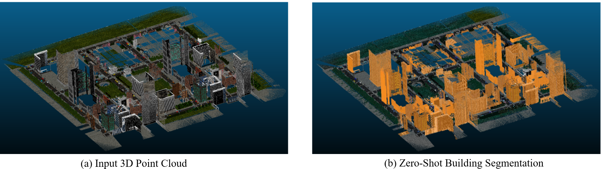
Zero-shot detection of buildings in mobile LiDAR using Language Vision Model
June Moh Goo, Zichao Zeng, Jan Boehm
0
0
Recent advances have demonstrated that Language Vision Models (LVMs) surpass the existing State-of-the-Art (SOTA) in two-dimensional (2D) computer vision tasks, motivating attempts to apply LVMs to three-dimensional (3D) data. While LVMs are efficient and effective in addressing various downstream 2D vision tasks without training, they face significant challenges when it comes to point clouds, a representative format for representing 3D data. It is more difficult to extract features from 3D data and there are challenges due to large data sizes and the cost of the collection and labelling, resulting in a notably limited availability of datasets. Moreover, constructing LVMs for point clouds is even more challenging due to the requirements for large amounts of data and training time. To address these issues, our research aims to 1) apply the Grounded SAM through Spherical Projection to transfer 3D to 2D, and 2) experiment with synthetic data to evaluate its effectiveness in bridging the gap between synthetic and real-world data domains. Our approach exhibited high performance with an accuracy of 0.96, an IoU of 0.85, precision of 0.92, recall of 0.91, and an F1 score of 0.92, confirming its potential. However, challenges such as occlusion problems and pixel-level overlaps of multi-label points during spherical image generation remain to be addressed in future studies.
4/16/2024

SynRS3D: A Synthetic Dataset for Global 3D Semantic Understanding from Monocular Remote Sensing Imagery
Jian Song, Hongruixuan Chen, Weihao Xuan, Junshi Xia, Naoto Yokoya
0
0
Global semantic 3D understanding from single-view high-resolution remote sensing (RS) imagery is crucial for Earth Observation (EO). However, this task faces significant challenges due to the high costs of annotations and data collection, as well as geographically restricted data availability. To address these challenges, synthetic data offer a promising solution by being easily accessible and thus enabling the provision of large and diverse datasets. We develop a specialized synthetic data generation pipeline for EO and introduce SynRS3D, the largest synthetic RS 3D dataset. SynRS3D comprises 69,667 high-resolution optical images that cover six different city styles worldwide and feature eight land cover types, precise height information, and building change masks. To further enhance its utility, we develop a novel multi-task unsupervised domain adaptation (UDA) method, RS3DAda, coupled with our synthetic dataset, which facilitates the RS-specific transition from synthetic to real scenarios for land cover mapping and height estimation tasks, ultimately enabling global monocular 3D semantic understanding based on synthetic data. Extensive experiments on various real-world datasets demonstrate the adaptability and effectiveness of our synthetic dataset and proposed RS3DAda method. SynRS3D and related codes will be available.
6/27/2024

Photorealistic 3D Urban Scene Reconstruction and Point Cloud Extraction using Google Earth Imagery and Gaussian Splatting
Kyle Gao, Dening Lu, Hongjie He, Linlin Xu, Jonathan Li
0
0
3D urban scene reconstruction and modelling is a crucial research area in remote sensing with numerous applications in academia, commerce, industry, and administration. Recent advancements in view synthesis models have facilitated photorealistic 3D reconstruction solely from 2D images. Leveraging Google Earth imagery, we construct a 3D Gaussian Splatting model of the Waterloo region centered on the University of Waterloo and are able to achieve view-synthesis results far exceeding previous 3D view-synthesis results based on neural radiance fields which we demonstrate in our benchmark. Additionally, we retrieved the 3D geometry of the scene using the 3D point cloud extracted from the 3D Gaussian Splatting model which we benchmarked against our Multi- View-Stereo dense reconstruction of the scene, thereby reconstructing both the 3D geometry and photorealistic lighting of the large-scale urban scene through 3D Gaussian Splatting
6/4/2024