Open Access Battle Damage Detection via Pixel-Wise T-Test on Sentinel-1 Imagery

0
Sign in to get full access
Overview
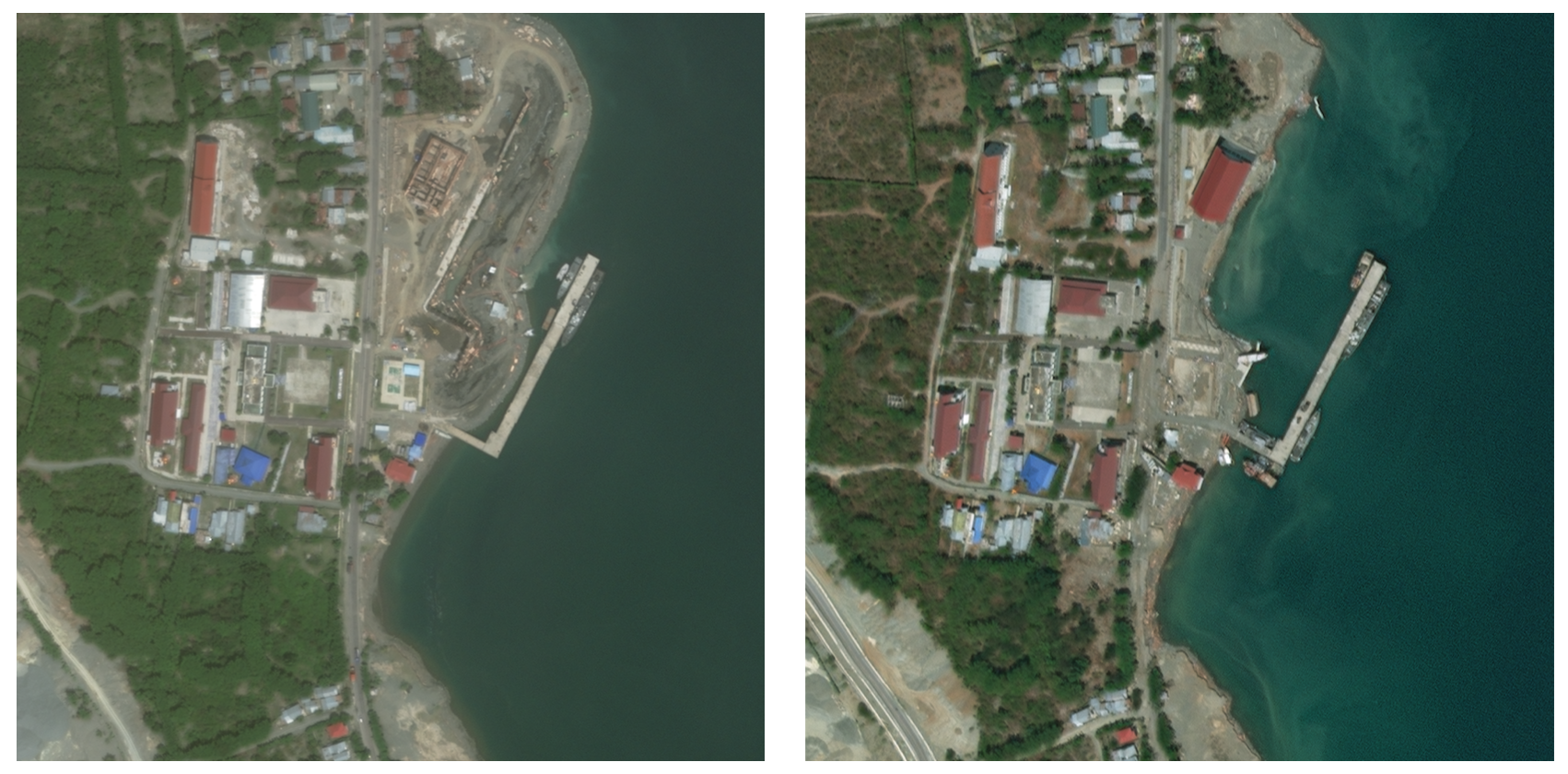
- This paper presents a pixel-wise t-test approach for detecting building damage in Sentinel-1 satellite imagery after natural disasters.
- The method compares pre- and post-disaster images to identify statistically significant changes that indicate potential damage.
- The authors evaluate their approach on a dataset of Sentinel-1 imagery collected before and after several recent hurricanes.
Plain English Explanation
The researchers in this study developed a new technique to automatically detect building damage in satellite images after natural disasters like hurricanes. Their approach looks at pairs of satellite images - one taken before the disaster and one taken after - and uses a statistical test called a t-test to identify pixels (small areas) in the images that have changed significantly. These changes could indicate that a building has been damaged.
The key advantage of this pixel-wise t-test approach is that it doesn't require any special training data or machine learning models. It can be applied directly to the satellite imagery without needing to first train a complex deep learning model on examples of damaged and undamaged buildings.
The researchers tested their method on Sentinel-1 satellite imagery collected before and after several major hurricanes. By comparing the pre- and post-disaster images, they were able to identify areas of potential building damage that could help responders target their recovery efforts.
Technical Explanation
The core of the authors' approach is a pixel-wise t-test that compares the pre- and post-disaster Sentinel-1 imagery to detect statistically significant changes. Specifically, they calculate a t-statistic for each pixel by comparing the backscatter values (a measure of how the ground reflects the satellite's radar signal) before and after the disaster event. Pixels with a high t-statistic indicate areas where the backscatter has changed significantly, which the authors interpret as potential building damage.
To evaluate their method, the researchers assembled a dataset of Sentinel-1 images covering several hurricane-affected regions. They applied the pixel-wise t-test to these image pairs and compared the resulting damage maps to ground truth data. The results showed that their approach was able to successfully identify many damaged areas, though the authors note that the technique can struggle to differentiate between damaged buildings and other types of ground changes.
Critical Analysis
One key limitation of the pixel-wise t-test approach is that it relies solely on changes in the satellite imagery, without incorporating any additional contextual information. This means it may struggle to accurately distinguish between actual building damage and other types of ground changes, such as flooding or vegetation changes. The authors acknowledge this issue and suggest that integrating the t-test results with other data sources, such as physical adversarial patches, could help improve the damage detection accuracy.
Additionally, the effectiveness of the technique may be influenced by factors like the resolution and quality of the Sentinel-1 imagery, as well as the specific characteristics of the disaster event and the affected buildings. Further research would be needed to fully understand the capabilities and limitations of the pixel-wise t-test approach across a wider range of disaster scenarios and data sources.
Conclusion
This paper presents a novel pixel-wise t-test method for automatically detecting building damage in Sentinel-1 satellite imagery after natural disasters. By comparing pre- and post-disaster images, the technique can identify statistically significant changes that may indicate damaged structures. While the approach has some limitations, it offers a promising alternative to more complex deep learning-based methods, particularly in situations where training data may be scarce. The authors' work highlights the potential for leveraging readily available satellite data to support rapid damage assessment and disaster response efforts.
This summary was produced with help from an AI and may contain inaccuracies - check out the links to read the original source documents!
Related Papers
0
Open Access Battle Damage Detection via Pixel-Wise T-Test on Sentinel-1 Imagery
Ollie Ballinger
In the context of recent, highly destructive conflicts in Gaza and Ukraine, reliable estimates of building damage are essential for an informed public discourse, human rights monitoring, and humanitarian aid provision. Given the contentious nature of conflict damage assessment, these estimates must be fully reproducible, explainable, and derived from open access data. This paper introduces a new method for building damage detection-- the Pixel-Wise T-Test (PWTT)-- that satisfies these conditions. Using a combination of freely-available synthetic aperture radar imagery and statistical change detection, the PWTT generates accurate conflict damage estimates across a wide area at regular time intervals. Accuracy is assessed using an original dataset of over half a million labeled building footprints spanning 12 cities across Ukraine, Palestine, Syria, and Iraq. Despite being simple and lightweight, the algorithm achieves building-level accuracy statistics (AUC=0.88 across Ukraine, 0.81 in Gaza) rivalling state of the art methods that use deep learning and high resolution imagery. The workflow is open source and deployed entirely within the Google Earth Engine environment, allowing for the generation of interactive Battle Damage Dashboards for Ukraine and Gaza that update in near-real time, allowing the public and humanitarian practitioners to immediately get estimates of damaged buildings in a given area.
Read more5/13/2024

0
An Open-Source Tool for Mapping War Destruction at Scale in Ukraine using Sentinel-1 Time Series
Olivier Dietrich, Torben Peters, Vivien Sainte Fare Garnot, Valerie Sticher, Thao Ton-That Whelan, Konrad Schindler, Jan Dirk Wegner
Access to detailed war impact assessments is crucial for humanitarian organizations to effectively assist populations most affected by armed conflicts. However, maintaining a comprehensive understanding of the situation on the ground is challenging, especially in conflicts that cover vast territories and extend over long periods. This study presents a scalable and transferable method for estimating war-induced damage to buildings. We first train a machine learning model to output pixel-wise probability of destruction from Synthetic Aperture Radar (SAR) satellite image time series, leveraging existing, manual damage assessments as ground truth and cloud-based geospatial analysis tools for large-scale inference. We further post-process these assessments using open building footprints to obtain a final damage estimate per building. We introduce an accessible, open-source tool that allows users to adjust the confidence interval based on their specific requirements and use cases. Our approach enables humanitarian organizations and other actors to rapidly screen large geographic regions for war impacts. We provide two publicly accessible dashboards: a Ukraine Damage Explorer to dynamically view our pre-computed estimates, and a Rapid Damage Mapping Tool to easily run our method and produce custom maps.
Read more6/5/2024

0
Post-hurricane building damage assessment using street-view imagery and structured data: A multi-modal deep learning approach
Zhuoqun Xue, Xiaojian Zhang, David O. Prevatt, Jennifer Bridge, Susu Xu, Xilei Zhao
Accurately assessing building damage is critical for disaster response and recovery. However, many existing models for detecting building damage have poor prediction accuracy due to their limited capabilities of identifying detailed, comprehensive structural and/or non-structural damage from the street-view image. Additionally, these models mainly rely on the imagery data for damage classification, failing to account for other critical information, such as wind speed, building characteristics, evacuation zones, and distance of the building to the hurricane track. To address these limitations, in this study, we propose a novel multi-modal (i.e., imagery and structured data) approach for post-hurricane building damage classification, named the Multi-Modal Swin Transformer (MMST). We empirically train and evaluate the proposed MMST using data collected from the 2022 Hurricane Ian in Florida, USA. Results show that MMST outperforms all selected state-of-the-art benchmark models and can achieve an accuracy of 92.67%, which are 7.71% improvement in accuracy compared to Visual Geometry Group 16 (VGG-16). In addition to the street-view imagery data, building value, building age, and wind speed are the most important predictors for damage level classification. The proposed MMST can be deployed to assist in rapid damage assessment and guide reconnaissance efforts in future hurricanes.
Read more4/12/2024
0
DeepDamageNet: A two-step deep-learning model for multi-disaster building damage segmentation and classification using satellite imagery
Irene Alisjahbana (Mullet), Jiawei Li (Mullet), Ben (Mullet), Strong, Yue Zhang
Satellite imagery has played an increasingly important role in post-disaster building damage assessment. Unfortunately, current methods still rely on manual visual interpretation, which is often time-consuming and can cause very low accuracy. To address the limitations of manual interpretation, there has been a significant increase in efforts to automate the process. We present a solution that performs the two most important tasks in building damage assessment, segmentation and classification, through deep-learning models. We show our results submitted as part of the xView2 Challenge, a competition to design better models for identifying buildings and their damage level after exposure to multiple kinds of natural disasters. Our best model couples a building identification semantic segmentation convolutional neural network (CNN) to a building damage classification CNN, with a combined F1 score of 0.66, surpassing the xView2 challenge baseline F1 score of 0.28. We find that though our model was able to identify buildings with relatively high accuracy, building damage classification across various disaster types is a difficult task due to the visual similarity between different damage levels and different damage distribution between disaster types, highlighting the fact that it may be important to have a probabilistic prior estimate regarding disaster damage in order to obtain accurate predictions.
Read more5/9/2024