Plant detection from ultra high resolution remote sensing images: A Semantic Segmentation approach based on fuzzy loss

0

Sign in to get full access
Overview
- Introduces a semantic segmentation approach for detecting plants from ultra-high-resolution remote sensing images
- Proposes a novel fuzzy loss function to address the challenges of class imbalance and ambiguous boundaries
- Demonstrates the effectiveness of the approach on a benchmark dataset
Plain English Explanation
The paper presents a semantic segmentation approach for detecting plants in ultra-high-resolution remote sensing images. Semantic segmentation is a computer vision technique that assigns a label to each pixel in an image, allowing for the identification of objects like plants.
The key innovation is the use of a fuzzy loss function to train the segmentation model. Traditional loss functions can struggle with class imbalance (where one class, like background, dominates) and ambiguous boundaries between objects. The fuzzy loss function is designed to address these challenges by allowing for partial or uncertain membership in multiple classes.
The authors evaluate their approach on a benchmark dataset of aerial imagery and demonstrate that it outperforms standard segmentation models. This suggests the fuzzy loss function can be an effective tool for plant detection from high-resolution aerial or satellite imagery, with potential applications in fields like precision agriculture, forestry, and urban planning.
Technical Explanation
The paper proposes a semantic segmentation approach for detecting plants from ultra-high-resolution remote sensing images. The key components are:
-
Dataset: The authors use a benchmark dataset of aerial imagery with pixel-level annotations for different plant species and other land cover types.
-
Model Architecture: They employ a standard convolutional neural network (CNN) architecture for semantic segmentation, with an encoder-decoder structure and skip connections.
-
Fuzzy Loss Function: To address the challenges of class imbalance and ambiguous boundaries, the authors introduce a novel fuzzy loss function. This allows the model to learn partial or uncertain membership in multiple classes, rather than forcing a hard classification at each pixel.
-
Training and Evaluation: The model is trained end-to-end using the fuzzy loss function. Evaluation metrics include pixel-wise accuracy, intersection-over-union (IoU), and F1 score, computed at both the pixel and object levels.
The results show that the proposed fuzzy loss function outperforms standard cross-entropy loss on the plant detection task, demonstrating the effectiveness of the approach. The authors discuss potential applications in fields like precision agriculture, forestry management, and urban planning.
Critical Analysis
The paper presents a novel and promising approach for plant detection from high-resolution remote sensing imagery. The use of a fuzzy loss function to handle class imbalance and boundary ambiguity is a thoughtful solution to common challenges in semantic segmentation.
However, the paper does not provide a detailed analysis of the limitations or potential drawbacks of the approach. For example, it would be helpful to understand how the fuzzy loss function impacts training complexity or convergence, or how it performs on datasets with different characteristics (e.g., varied plant species, environmental conditions, or image resolutions).
Additionally, while the results demonstrate improved performance, the paper could benefit from a more in-depth discussion of the practical implications and real-world applications of the technology. For instance, how might the plant detection accuracy and efficiency translate to specific use cases, and what are the potential barriers to adoption?
Overall, the research appears sound and the proposed method shows promise, but further exploration of the limitations and potential extensions of the work would strengthen the paper and provide a more comprehensive understanding of the approach.
Conclusion
This paper presents a semantic segmentation approach for detecting plants from ultra-high-resolution remote sensing images, with a novel fuzzy loss function to address challenges like class imbalance and ambiguous boundaries. The results demonstrate the effectiveness of the method on a benchmark dataset, suggesting it could be a valuable tool for applications in precision agriculture, forestry management, and urban planning. While the paper could benefit from a more in-depth discussion of limitations and real-world implications, the research represents a promising advance in the field of plant detection from aerial imagery.
This summary was produced with help from an AI and may contain inaccuracies - check out the links to read the original source documents!
Related Papers
0
Plant detection from ultra high resolution remote sensing images: A Semantic Segmentation approach based on fuzzy loss
Shivam Pande, Baki Uzun, Florent Guiotte, Thomas Corpetti, Florian Delerue, S'ebastien Lef`evre
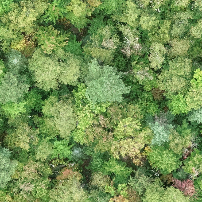
In this study, we tackle the challenge of identifying plant species from ultra high resolution (UHR) remote sensing images. Our approach involves introducing an RGB remote sensing dataset, characterized by millimeter-level spatial resolution, meticulously curated through several field expeditions across a mountainous region in France covering various landscapes. The task of plant species identification is framed as a semantic segmentation problem for its practical and efficient implementation across vast geographical areas. However, when dealing with segmentation masks, we confront instances where distinguishing boundaries between plant species and their background is challenging. We tackle this issue by introducing a fuzzy loss within the segmentation model. Instead of utilizing one-hot encoded ground truth (GT), our model incorporates Gaussian filter refined GT, introducing stochasticity during training. First experimental results obtained on both our UHR dataset and a public dataset are presented, showing the relevance of the proposed methodology, as well as the need for future improvement.
Read more9/4/2024
0
Tree semantic segmentation from aerial image time series
Venkatesh Ramesh, Arthur Ouaknine, David Rolnick
Earth's forests play an important role in the fight against climate change, and are in turn negatively affected by it. Effective monitoring of different tree species is essential to understanding and improving the health and biodiversity of forests. In this work, we address the challenge of tree species identification by performing semantic segmentation of trees using an aerial image dataset spanning over a year. We compare models trained on single images versus those trained on time series to assess the impact of tree phenology on segmentation performances. We also introduce a simple convolutional block for extracting spatio-temporal features from image time series, enabling the use of popular pretrained backbones and methods. We leverage the hierarchical structure of tree species taxonomy by incorporating a custom loss function that refines predictions at three levels: species, genus, and higher-level taxa. Our findings demonstrate the superiority of our methodology in exploiting the time series modality and confirm that enriching labels using taxonomic information improves the semantic segmentation performance.
Read more7/19/2024
🤷
0
Applying Unsupervised Semantic Segmentation to High-Resolution UAV Imagery for Enhanced Road Scene Parsing
Zihan Ma, Yongshang Li, Ronggui Ma, Chen Liang
There are two challenges presented in parsing road scenes from UAV images: the complexity of processing high-resolution images and the dependency on extensive manual annotations required by traditional supervised deep learning methods to train robust and accurate models. In this paper, a novel unsupervised road parsing framework that leverages advancements in vision language models with fundamental computer vision techniques is introduced to address these critical challenges. Our approach initiates with a vision language model that efficiently processes ultra-high resolution images to rapidly identify road regions of interest. Subsequent application of the vision foundation model, SAM, generates masks for these regions without requiring category information. A self-supervised learning network then processes these masked regions to extract feature representations, which are clustered using an unsupervised algorithm that assigns unique IDs to each feature cluster. The masked regions are combined with the corresponding IDs to generate initial pseudo-labels, which initiate an iterative self-training process for regular semantic segmentation. Remarkably, the proposed method achieves a mean Intersection over Union (mIoU) of 89.96% on the development dataset without any manual annotation, demonstrating extraordinary flexibility by surpassing the limitations of human-defined categories, and autonomously acquiring knowledge of new categories from the dataset itself.
Read more4/30/2024

0
Challenges in automatic and selective plant-clearing
Fabrice Mayran de Chamisso, Loic Cotten, Valentine Dhers, Thomas Lompech, Florian Seywert, Arnaud Susset
With the advent of multispectral imagery and AI, there have been numerous works on automatic plant segmentation for purposes such as counting, picking, health monitoring, localized pesticide delivery, etc. In this paper, we tackle the related problem of automatic and selective plant-clearing in a sustainable forestry context, where an autonomous machine has to detect and avoid specific plants while clearing any weeds which may compete with the species being cultivated. Such an autonomous system requires a high level of robustness to weather conditions, plant variability, terrain and weeds while remaining cheap and easy to maintain. We notably discuss the lack of robustness of spectral imagery, investigate the impact of the reference database's size and discuss issues specific to AI systems operating in uncontrolled environments.
Read more4/23/2024