Tree species classification at the pixel-level using deep learning and multispectral time series in an imbalanced context

0
🏷️
Sign in to get full access
Overview
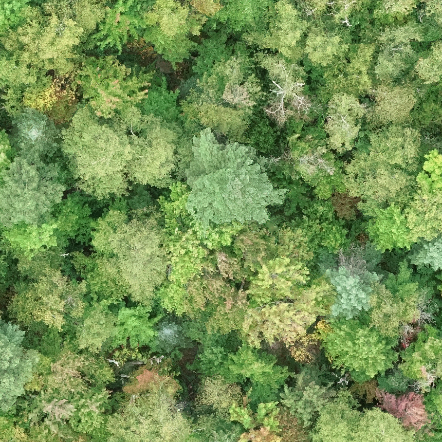
- This paper examines the use of Sentinel-2 satellite image time-series for classifying different tree species.
- Accurate maps of tree species are important but often unavailable or outdated for large areas.
- The study compares the performance of deep learning models to the standard Random Forest algorithm for tree species classification.
- The deep learning models significantly outperform Random Forest, especially for minority tree species.
- The proposed deep learning framework is a strong baseline that can be easily implemented even with limited reference data.
Plain English Explanation
The research paper looks at using satellite images over time to identify different types of trees. Knowing the specific tree species in an area is crucial for many applications, like forest management and conservation. However, detailed tree maps are often missing or out of date, especially for large regions.
The researchers tested different machine learning approaches to classify 10 tree species in central France using Sentinel-2 satellite data. They found that deep learning models significantly outperformed the commonly used Random Forest algorithm. The deep learning methods achieved around 95% overall accuracy and 80% F1-score, compared to 93% accuracy and 60% F1-score for Random Forest.
The key advantage of the deep learning models is that they were better at identifying the less common tree species, which the Random Forest model tended to misclassify. The researchers' deep learning framework provides a strong starting point that can be easily applied in other tree mapping scenarios, even when limited training data is available.
Overall, the study demonstrates the power of deep learning techniques for accurately mapping the distribution of different tree species over large areas using satellite imagery. This could lead to better forest monitoring and management to support environmental sustainability.
Technical Explanation
The paper explores the use of Sentinel-2 multispectral satellite image time-series for classifying 10 different tree species in central France. The researchers compare the performance of several deep learning architectures, including multilayer perceptrons, convolutional neural networks, and attention-based models, to the standard Random Forest (RF) algorithm.
The deep learning models significantly outperformed RF, achieving an overall accuracy around 95% and a macro-F1 score around 80%, compared to 93% accuracy and 60% F1-score for RF. This indicates the deep learning models were much better at correctly identifying the minority tree species, which the RF algorithm tended to misclassify.
The researchers' proposed deep learning framework provides a strong baseline that can be easily implemented in most scenarios, even with limited training data. Their results show that a standard multilayer perceptron with batch normalization can be competitive when properly scaled, and that more complex architectures like CNNs and attention-based models can also achieve strong performance when tuned appropriately.
Furthermore, the study finds that deep learning models are naturally robust to imbalanced data, where certain tree species are underrepresented in the training set. This is a common challenge in real-world tree mapping applications.
Critical Analysis
The paper provides a thorough evaluation of several deep learning approaches for tree species classification from satellite imagery, offering a strong baseline for future research. However, the authors acknowledge some limitations:
- The study is focused on a specific region in central France, so the generalizability of the results to other geographic areas or tree species compositions remains to be tested.
- The paper does not explore the impact of incorporating additional remote sensing data sources, such as LiDAR or hyperspectral imagery, which could further improve classification accuracy.
- While the deep learning models demonstrate robustness to imbalanced data, the authors do not investigate the use of specialized techniques, such as oversampling or class weighting, to address this challenge.
Future research could investigate the transferability of the deep learning models to new regions, experiment with multimodal data fusion, and explore advanced methods for handling class imbalance in the tree species classification task.
Conclusion
This research paper presents a compelling case for the use of deep learning techniques to accurately map the distribution of different tree species over large areas using satellite image time-series. The deep learning models significantly outperformed the standard Random Forest algorithm, especially in correctly identifying minority tree species.
The proposed deep learning framework offers a strong baseline that can be easily implemented in various tree mapping scenarios, even with limited reference data. This could lead to the development of more comprehensive and up-to-date tree species maps, which are crucial for forest management, conservation, and environmental sustainability efforts.
Overall, this study contributes an important step towards leveraging the power of deep learning and remote sensing technology to better understand and monitor the world's forests.
This summary was produced with help from an AI and may contain inaccuracies - check out the links to read the original source documents!
Related Papers
🏷️
0
Tree species classification at the pixel-level using deep learning and multispectral time series in an imbalanced context
Florian Mouret (CESBIO, UO), David Morin (CESBIO), Milena Planells (CESBIO), C'ecile Vincent-Barbaroux
This paper investigates tree species classification using Sentinel-2 multispectral satellite image time-series. Despite their critical importance for many applications, such maps are often unavailable, outdated, or inaccurate for large areas. The interest of using remote sensing time series to produce these maps has been highlighted in many studies. However, many methods proposed in the literature still rely on a standard classification algorithm, usually the Random Forest (RF) algorithm with vegetation indices. This study shows that the use of deep learning models can lead to a significant improvement in classification results, especially in an imbalanced context where the RF algorithm tends to predict towards the majority class. In our use case in the center of France with 10 tree species, we obtain an overall accuracy (OA) around 95% and a F1-macro score around 80% using three different benchmark deep learning architectures. In contrast, using the RF algorithm yields an OA of 93% and an F1 of 60%, indicating that the minority classes are not classified with sufficient accuracy. Therefore, the proposed framework is a strong baseline that can be easily implemented in most scenarios, even with a limited amount of reference data. Our results highlight that standard multilayer perceptron can be competitive with batch normalization and a sufficient amount of parameters. Other architectures (convolutional or attention-based) can also achieve strong results when tuned properly. Furthermore, our results show that DL models are naturally robust to imbalanced data, although similar results can be obtained using dedicated techniques.
Read more8/20/2024
🔎
0
Individual Tree Detection in Large-Scale Urban Environments using High-Resolution Multispectral Imagery
Jonathan Ventura, Camille Pawlak, Milo Honsberger, Cameron Gonsalves, Julian Rice, Natalie L. R. Love, Skyler Han, Viet Nguyen, Keilana Sugano, Jacqueline Doremus, G. Andrew Fricker, Jenn Yost, Matt Ritter
We introduce a novel deep learning method for detection of individual trees in urban environments using high-resolution multispectral aerial imagery. We use a convolutional neural network to regress a confidence map indicating the locations of individual trees, which are localized using a peak finding algorithm. Our method provides complete spatial coverage by detecting trees in both public and private spaces, and can scale to very large areas. We performed a thorough evaluation of our method, supported by a new dataset of over 1,500 images and almost 100,000 tree annotations, covering eight cities, six climate zones, and three image capture years. We trained our model on data from Southern California, and achieved a precision of 73.6% and recall of 73.3% using test data from this region. We generally observed similar precision and slightly lower recall when extrapolating to other California climate zones and image capture dates. We used our method to produce a map of trees in the entire urban forest of California, and estimated the total number of urban trees in California to be about 43.5 million. Our study indicates the potential for deep learning methods to support future urban forestry studies at unprecedented scales.
Read more7/4/2024
0
Tree semantic segmentation from aerial image time series
Venkatesh Ramesh, Arthur Ouaknine, David Rolnick
Earth's forests play an important role in the fight against climate change, and are in turn negatively affected by it. Effective monitoring of different tree species is essential to understanding and improving the health and biodiversity of forests. In this work, we address the challenge of tree species identification by performing semantic segmentation of trees using an aerial image dataset spanning over a year. We compare models trained on single images versus those trained on time series to assess the impact of tree phenology on segmentation performances. We also introduce a simple convolutional block for extracting spatio-temporal features from image time series, enabling the use of popular pretrained backbones and methods. We leverage the hierarchical structure of tree species taxonomy by incorporating a custom loss function that refines predictions at three levels: species, genus, and higher-level taxa. Our findings demonstrate the superiority of our methodology in exploiting the time series modality and confirm that enriching labels using taxonomic information improves the semantic segmentation performance.
Read more7/19/2024
📊
0
Estimating optical vegetation indices and biophysical variables for temperate forests with Sentinel-1 SAR data using machine learning techniques: A case study for Czechia
Daniel Paluba, Bertrand Le Saux, Pv{r}emysl Stych
Current optical vegetation indices (VIs) for monitoring forest ecosystems are well established and widely used in various applications, but can be limited by atmospheric effects such as clouds. In contrast, synthetic aperture radar (SAR) data can offer insightful and systematic forest monitoring with complete time series (TS) due to signal penetration through clouds and day and night image acquisitions. This study aims to address the limitations of optical satellite data by using SAR data as an alternative for estimating optical VIs for forests through machine learning (ML). While this approach is less direct and likely only feasible through the power of ML, it raises the scientific question of whether enough relevant information is contained in the SAR signal to accurately estimate VIs. This work covers the estimation of TS of four VIs (LAI, FAPAR, EVI and NDVI) using multitemporal Sentinel-1 SAR and ancillary data. The study focused on both healthy and disturbed temperate forest areas in Czechia for the year 2021, while ground truth labels generated from Sentinel-2 multispectral data. This was enabled by creating a paired multi-modal TS dataset in Google Earth Engine (GEE), including temporally and spatially aligned Sentinel-1, Sentinel-2, DEM, weather and land cover datasets. The inclusion of DEM-derived auxiliary features and additional meteorological information, further improved the results. In the comparison of ML models, the traditional ML algorithms, RFR and XGBoost slightly outperformed the AutoML approach, auto-sklearn, for all VIs, achieving high accuracies ($R^2$ between 70-86%) and low errors (0.055-0.29 of MAE). In general, up to 240 measurements per year and a spatial resolution of 20 m can be achieved using estimated SAR-based VIs with high accuracy. A great advantage of the SAR-based VI is the ability to detect abrupt forest changes with sub-weekly temporal accuracy.
Read more8/28/2024