Cooperative Indoor Exploration Leveraging a Mixed-Size UAV Team with Heterogeneous Sensors

0
Sign in to get full access
Overview
- This research paper explores the use of a mixed-size team of unmanned aerial vehicles (UAVs) with heterogeneous sensors for cooperative indoor exploration.
- The goal is to efficiently map and explore unstructured indoor environments by leveraging the unique capabilities of different-sized UAVs.
- The proposed approach involves coordinating the UAV team to ensure comprehensive coverage and effective information gathering.
Plain English Explanation
Imagine a group of small and large drones working together to explore a complex indoor space, like a building with many rooms and obstacles. The researchers in this paper wanted to find a way for these different-sized drones to work as a team to map out the entire area efficiently.
The key idea is that the smaller drones can navigate through tight spaces and get into hard-to-reach areas, while the larger drones can cover more ground and have more powerful sensors. By coordinating the drones and having them share information, they can build a complete picture of the indoor environment, even if it's cluttered or difficult to access.
This could be useful for applications like search and rescue operations, infrastructure inspection, or even urban surveillance. The mixed-size drone team can navigate complex indoor spaces more effectively than a single drone or a homogeneous team.
Technical Explanation
The researchers propose a framework for coordinating a mixed-size UAV team with heterogeneous sensors to cooperatively explore indoor environments. The key components include:
- Task Allocation: The system assigns exploration tasks to individual UAVs based on their capabilities and the current state of the environment.
- Information Sharing: The UAVs continuously share sensor data and map information with each other to maintain a global understanding of the environment.
- Path Planning: Each UAV plans its own path to efficiently cover its assigned exploration area while avoiding obstacles and coordinating with the team.
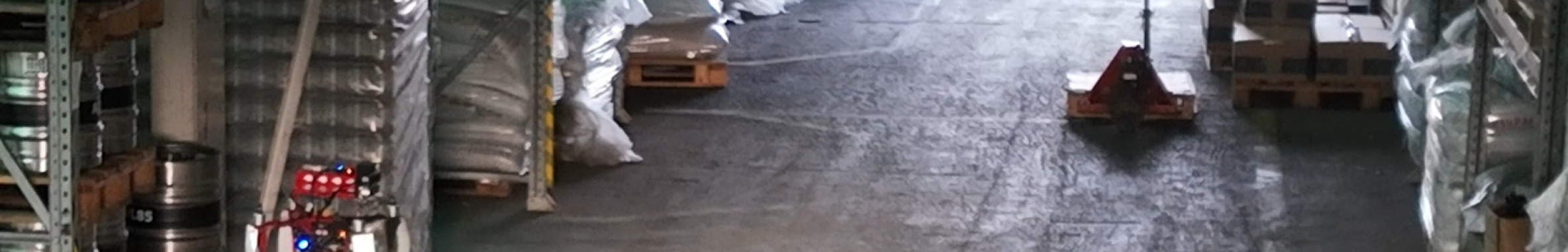
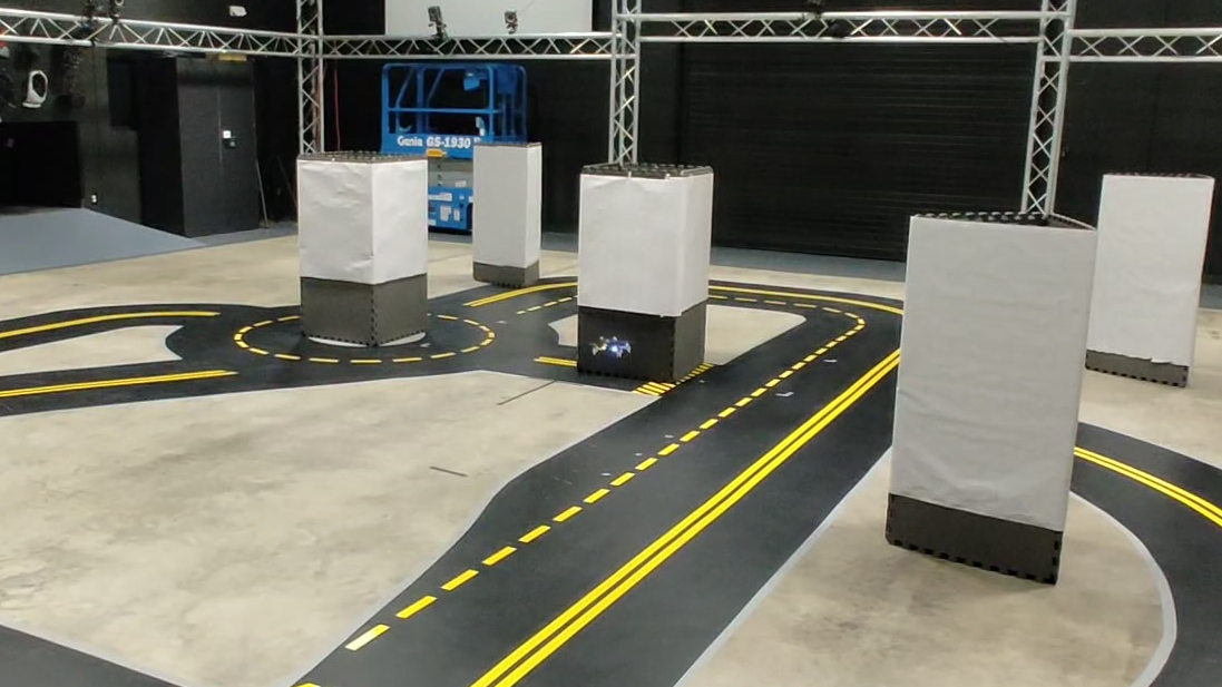
The researchers conducted simulations and real-world experiments to evaluate the performance of their approach. They compared it to alternative strategies, such as using a single large UAV or a homogeneous team of small UAVs. The results demonstrated the advantages of the mixed-size UAV team in terms of coverage, exploration time, and map reconstruction quality.
Critical Analysis
The research paper presents a promising approach for indoor exploration using a mixed-size UAV team, but it also acknowledges several limitations and areas for further investigation:
- The current system assumes a priori knowledge of the UAVs' capabilities and sensor characteristics, which may not always be available in real-world scenarios.
- The path planning and task allocation algorithms rely on centralized coordination, which could be a potential bottleneck for scalability and robustness.
- The experiments were conducted in relatively simple indoor environments, and the performance in more complex, cluttered, or dynamic settings remains to be evaluated.
Additionally, the paper does not address potential privacy and security concerns that may arise from using UAVs for indoor exploration, particularly in sensitive or public spaces. Further research is needed to address these ethical and regulatory considerations.
Conclusion
This research demonstrates the potential of leveraging a mixed-size UAV team with heterogeneous sensors for efficient and comprehensive indoor exploration. By combining the strengths of different-sized drones, the proposed approach can navigate complex indoor environments more effectively than using a single drone or a homogeneous team.
The findings have implications for a variety of applications, from search and rescue operations to infrastructure inspection and urban surveillance. However, the researchers acknowledge the need for further advancements in areas such as autonomous coordination, sensor integration, and ethical considerations to fully realize the benefits of this technology.
This summary was produced with help from an AI and may contain inaccuracies - check out the links to read the original source documents!
Related Papers
0
Cooperative Indoor Exploration Leveraging a Mixed-Size UAV Team with Heterogeneous Sensors
Michaela Cihl'av{r}ov'a, V'aclav Pritzl, Martin Saska
Heterogeneous teams of Unmanned Aerial Vehicles (UAVs) can enhance the exploration capabilities of aerial robots by exploiting different strengths and abilities of varying UAVs. This paper presents a novel method for exploring unknown indoor spaces with a team of UAVs of different sizes and sensory equipment. We propose a frontier-based exploration with two task allocation strategies: a greedy strategy that assigns Points of Interest (POIs) based on Euclidean distance and UAV priority and an optimization strategy that solves a minimum-cost flow problem. The proposed method utilizes the SphereMap algorithm to assess the accessibility of the POIs and generate paths that account for obstacle distances, including collision avoidance maneuvers among UAVs. The proposed approach was validated through simulation testing and real-world experiments that evaluated the method's performance on board the UAVs.
Read more7/15/2024
0
Exploring Unstructured Environments using Minimal Sensing on Cooperative Nano-Drones
Pedro Arias-Perez, Alvika Gautam, Miguel Fernandez-Cortizas, David Perez-Saura, Srikanth Saripalli, Pascual Campoy
Recent advances have improved autonomous navigation and mapping under payload constraints, but current multi-robot inspection algorithms are unsuitable for nano-drones due to their need for heavy sensors and high computational resources. To address these challenges, we introduce ExploreBug, a novel hybrid frontier range bug algorithm designed to handle limited sensing capabilities for a swarm of nano-drones. This system includes three primary components: a mapping subsystem, an exploration subsystem, and a navigation subsystem. Additionally, an intra-swarm collision avoidance system is integrated to prevent collisions between drones. We validate the efficacy of our approach through extensive simulations and real-world exploration experiments involving up to seven drones in simulations and three in real-world settings, across various obstacle configurations and with a maximum navigation speed of 0.75 m/s. Our tests demonstrate that the algorithm efficiently completes exploration tasks, even with minimal sensing, across different swarm sizes and obstacle densities. Furthermore, our frontier allocation heuristic ensures an equal distribution of explored areas and paths traveled by each drone in the swarm. We publicly release the source code of the proposed system to foster further developments in mapping and exploration using autonomous nano drones.
Read more7/10/2024

0
SOAR: Simultaneous Exploration and Photographing with Heterogeneous UAVs for Fast Autonomous Reconstruction
Mingjie Zhang, Chen Feng, Zengzhi Li, Guiyong Zheng, Yiming Luo, Zhu Wang, Jinni Zhou, Shaojie Shen, Boyu Zhou
Unmanned Aerial Vehicles (UAVs) have gained significant popularity in scene reconstruction. This paper presents SOAR, a LiDAR-Visual heterogeneous multi-UAV system specifically designed for fast autonomous reconstruction of complex environments. Our system comprises a LiDAR-equipped explorer with a large field-of-view (FoV), alongside photographers equipped with cameras. To ensure rapid acquisition of the scene's surface geometry, we employ a surface frontier-based exploration strategy for the explorer. As the surface is progressively explored, we identify the uncovered areas and generate viewpoints incrementally. These viewpoints are then assigned to photographers through solving a Consistent Multiple Depot Multiple Traveling Salesman Problem (Consistent-MDMTSP), which optimizes scanning efficiency while ensuring task consistency. Finally, photographers utilize the assigned viewpoints to determine optimal coverage paths for acquiring images. We present extensive benchmarks in the realistic simulator, which validates the performance of SOAR compared with classical and state-of-the-art methods. For more details, please see our project page at https://sysu-star.github.io/SOAR}{sysu-star.github.io/SOAR.
Read more9/5/2024

0
An Active Search Strategy with Multiple Unmanned Aerial Systems for Multiple Targets
Chuanxiang Gao, Xinyi Wang, Xi Chen, Ben M. Chen
The challenge of efficient target searching in vast natural environments has driven the need for advanced multi-UAV active search strategies. This paper introduces a novel method in which global and local information is adeptly merged to avoid issues such as myopia and redundant back-and-forth movements. In addition, a trajectory generation method is used to ensure the search pattern within continuous space. To further optimize multi-agent cooperation, the Voronoi partition technique is employed, ensuring a reduction in repetitive flight patterns and making the control of multiple agents in a decentralized way. Through a series of experiments, the evaluation and comparison results demonstrate the efficiency of our approach in various environments. The primary application of this innovative approach is demonstrated in the search for horseshoe crabs within their wild habitats, showcasing its potential to revolutionize ecological survey and conservation efforts.
Read more6/26/2024