psPRF:Pansharpening Planar Neural Radiance Field for Generalized 3D Reconstruction Satellite Imagery

0

Sign in to get full access
Overview
- This paper introduces a new method called psPRF (Pansharpening Planar Neural Radiance Field) for 3D reconstruction of satellite imagery.
- The method combines pansharpening techniques with a neural radiance field (NeRF) approach to create high-quality 3D models from multimodal satellite data.
- psPRF aims to address challenges in existing methods, such as limited scalability and inability to handle varying terrain and illumination conditions.
Plain English Explanation
psPRF is a technique that takes satellite images and creates detailed 3D models of the scenes they depict. It works by combining two powerful techniques: pansharpening and neural radiance fields.
Pansharpening is a way to enhance the resolution of satellite images. Satellite cameras often capture images at different resolutions, with some images being lower quality but covering a wider area, and others being higher quality but covering a smaller area. Pansharpening combines these different images to create a single, high-resolution image that captures all the detail.
Neural radiance fields (NeRFs) are a type of 3D modeling technique that uses machine learning to create realistic 3D models from 2D images. Instead of building the 3D model out of basic geometric shapes, NeRFs learn the underlying 'radiance field' that describes how light interacts with the scene, allowing them to generate highly detailed and accurate 3D models.
By combining pansharpening and NeRFs, psPRF is able to create 3D models of satellite imagery that are both high-resolution and highly realistic. This could be useful for a variety of applications, such as urban planning, disaster response, and environmental monitoring, where accurate 3D models of large geographic areas are needed.
Technical Explanation
The psPRF method builds on the bilateral-guided radiance field processing and VRS-NeRF techniques to create a new approach for 3D reconstruction of satellite imagery.
The key innovations of psPRF include:
-
Pansharpening-guided NeRF Representation: The method uses pansharpening to fuse lower-resolution multispectral images with higher-resolution panchromatic images, creating a high-resolution multimodal input for the NeRF model.
-
Planar NeRF Architecture: Instead of modeling the entire 3D scene, psPRF uses a planar NeRF architecture that focuses on reconstructing the ground plane, which is often the most important part of satellite imagery.
-
Generalized Terrain and Illumination Handling: The planar NeRF model is able to handle varying terrain and illumination conditions, addressing limitations of prior NeRF-based methods for satellite 3D reconstruction.
The paper presents extensive experiments evaluating psPRF on diverse satellite datasets, demonstrating significant improvements in 3D reconstruction quality compared to state-of-the-art methods. The authors also discuss potential applications and directions for future research.
Critical Analysis
The psPRF method represents an important advancement in the field of 3D reconstruction from satellite imagery. By combining pansharpening and planar NeRFs, the authors have addressed several key challenges in this domain, such as limited scalability and inability to handle varying terrain and illumination conditions.
However, the paper does acknowledge some limitations of the approach. For example, the planar NeRF architecture may not be able to accurately capture complex 3D structures, such as tall buildings or mountainous regions. Additionally, the method still relies on the availability of high-quality multimodal satellite data, which may not be readily available in all scenarios.
Further research could explore ways to extend the psPRF approach to handle full 3D reconstruction, potentially by integrating techniques from multiplane prior guided few-shot aerial scene or fNeRF reconstruction. Exploring ways to make the method more robust to data scarcity, as in ID-NeRF, could also be a fruitful direction.
Conclusion
The psPRF method represents a significant advancement in the field of 3D reconstruction from satellite imagery. By combining pansharpening and planar neural radiance fields, the authors have developed a technique that can create high-quality 3D models from multimodal satellite data, addressing key limitations of prior approaches.
The method's ability to handle varying terrain and illumination conditions, as well as its potential for scalability, make it a promising tool for a wide range of applications, from urban planning to environmental monitoring. While the approach has some limitations, the insights and techniques presented in this paper lay the groundwork for future developments in this important and rapidly evolving field.
This summary was produced with help from an AI and may contain inaccuracies - check out the links to read the original source documents!
Related Papers
0
psPRF:Pansharpening Planar Neural Radiance Field for Generalized 3D Reconstruction Satellite Imagery
Tongtong Zhang, Yuanxiang Li
Most current NeRF variants for satellites are designed for one specific scene and fall short of generalization to new geometry. Additionally, the RGB images require pan-sharpening as an independent preprocessing step. This paper introduces psPRF, a Planar Neural Radiance Field designed for paired low-resolution RGB (LR-RGB) and high-resolution panchromatic (HR-PAN) images from satellite sensors with Rational Polynomial Cameras (RPC). To capture the cross-modal prior from both of the LR-RGB and HR-PAN images, for the Unet-shaped architecture, we adapt the encoder with explicit spectral-to-spatial convolution (SSConv) to enhance the multimodal representation ability. To support the generalization ability of psRPF across scenes, we adopt projection loss to ensure strong geometry self-supervision. The proposed method is evaluated with the multi-scene WorldView-3 LR-RGB and HR-PAN pairs, and achieves state-of-the-art performance.
Read more6/26/2024

0
New!BRDF-NeRF: Neural Radiance Fields with Optical Satellite Images and BRDF Modelling
Lulin Zhang, Ewelina Rupnik, Tri Dung Nguyen, St'ephane Jacquemoud, Yann Klinger
Understanding the anisotropic reflectance of complex Earth surfaces from satellite imagery is crucial for numerous applications. Neural radiance fields (NeRF) have become popular as a machine learning technique capable of deducing the bidirectional reflectance distribution function (BRDF) of a scene from multiple images. However, prior research has largely concentrated on applying NeRF to close-range imagery, estimating basic Microfacet BRDF models, which fall short for many Earth surfaces. Moreover, high-quality NeRFs generally require several images captured simultaneously, a rare occurrence in satellite imaging. To address these limitations, we propose BRDF-NeRF, developed to explicitly estimate the Rahman-Pinty-Verstraete (RPV) model, a semi-empirical BRDF model commonly employed in remote sensing. We assess our approach using two datasets: (1) Djibouti, captured in a single epoch at varying viewing angles with a fixed Sun position, and (2) Lanzhou, captured over multiple epochs with different viewing angles and Sun positions. Our results, based on only three to four satellite images for training, demonstrate that BRDF-NeRF can effectively synthesize novel views from directions far removed from the training data and produce high-quality digital surface models (DSMs).
Read more9/19/2024

0
Bilateral Guided Radiance Field Processing
Yuehao Wang, Chaoyi Wang, Bingchen Gong, Tianfan Xue
Neural Radiance Fields (NeRF) achieves unprecedented performance in synthesizing novel view synthesis, utilizing multi-view consistency. When capturing multiple inputs, image signal processing (ISP) in modern cameras will independently enhance them, including exposure adjustment, color correction, local tone mapping, etc. While these processings greatly improve image quality, they often break the multi-view consistency assumption, leading to floaters in the reconstructed radiance fields. To address this concern without compromising visual aesthetics, we aim to first disentangle the enhancement by ISP at the NeRF training stage and re-apply user-desired enhancements to the reconstructed radiance fields at the finishing stage. Furthermore, to make the re-applied enhancements consistent between novel views, we need to perform imaging signal processing in 3D space (i.e. 3D ISP). For this goal, we adopt the bilateral grid, a locally-affine model, as a generalized representation of ISP processing. Specifically, we optimize per-view 3D bilateral grids with radiance fields to approximate the effects of camera pipelines for each input view. To achieve user-adjustable 3D finishing, we propose to learn a low-rank 4D bilateral grid from a given single view edit, lifting photo enhancements to the whole 3D scene. We demonstrate our approach can boost the visual quality of novel view synthesis by effectively removing floaters and performing enhancements from user retouching. The source code and our data are available at: https://bilarfpro.github.io.
Read more8/9/2024
0
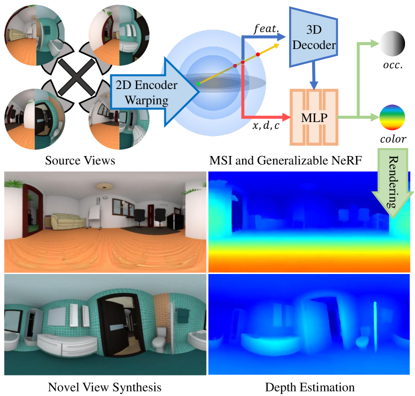
MSI-NeRF: Linking Omni-Depth with View Synthesis through Multi-Sphere Image aided Generalizable Neural Radiance Field
Dongyu Yan, Guanyu Huang, Fengyu Quan, Haoyao Chen
Panoramic observation using fisheye cameras is significant in virtual reality (VR) and robot perception. However, panoramic images synthesized by traditional methods lack depth information and can only provide three degrees-of-freedom (3DoF) rotation rendering in VR applications. To fully preserve and exploit the parallax information within the original fisheye cameras, we introduce MSI-NeRF, which combines deep learning omnidirectional depth estimation and novel view synthesis. We construct a multi-sphere image as a cost volume through feature extraction and warping of the input images. We further build an implicit radiance field using spatial points and interpolated 3D feature vectors as input, which can simultaneously realize omnidirectional depth estimation and 6DoF view synthesis. Leveraging the knowledge from depth estimation task, our method can learn scene appearance by source view supervision only. It does not require novel target views and can be trained conveniently on existing panorama depth estimation datasets. Our network has the generalization ability to reconstruct unknown scenes efficiently using only four images. Experimental results show that our method outperforms existing methods in both depth estimation and novel view synthesis tasks.
Read more7/23/2024