Visual Geo-Localization from images

0
Sign in to get full access
Overview
- This paper proposes a visual geo-localization system that can determine the location where an image was taken.
- The approach leverages deep learning models to extract features from images and match them against a database of geo-tagged images to infer the location.
- The system is designed to handle challenging scenarios such as varying viewpoints, weather conditions, and seasonal changes.
Plain English Explanation
Visual geo-localization is the process of determining the geographic location where a photo or image was captured. This can be a useful capability for a variety of applications, such as augmented reality, autonomous navigation, and place recognition.
The proposed system in this paper aims to tackle the challenge of cross-view geo-localization, where the input image may be captured from a different viewpoint or under different conditions than the reference images in the database. This is particularly important for real-world scenarios where the user may take a photo from their smartphone in varying environments.
The key idea is to use deep learning models to extract useful visual features from the input image and match them against a database of geo-tagged reference images. By finding the closest match, the system can infer the likely location where the input image was taken.
Technical Explanation
The paper presents a deep learning-based visual geo-localization system that consists of several key components:
-
Feature Extraction: A deep neural network is used to extract visual features from the input image. This could be a pre-trained model like ResNet or a custom architecture.
-
Retrieval: The extracted features are then matched against a database of geo-tagged reference images to find the closest visual matches. This is typically done using a nearest-neighbor search technique.
-
Localization: Once the closest matching reference images are identified, the system can infer the geographic coordinates of the input image by aggregating the location information associated with the reference images.
The authors evaluate their approach on several benchmark datasets and show that it outperforms previous methods, particularly in challenging cross-view scenarios where the input image may have a different viewpoint or be captured under different conditions compared to the reference images.
Critical Analysis
The paper presents a compelling approach to visual geo-localization that addresses some of the key challenges in the field. However, a few potential limitations and areas for further research are worth noting:
- The system relies on a pre-existing database of geo-tagged reference images, which may not always be available or comprehensive, especially in less-populated areas.
- The performance of the system is still limited by the ability of the deep learning models to extract robust and discriminative visual features, particularly in the face of significant viewpoint or environmental changes.
- The paper does not provide a thorough analysis of the computational and storage requirements of the system, which could be an important practical consideration for real-world deployment.
Additionally, it would be interesting to see how the proposed approach could be extended to incorporate other modalities, such as textual descriptions or sensor data, to further improve the accuracy and robustness of the geo-localization system.
Conclusion
This paper presents a promising deep learning-based approach to visual geo-localization that can handle challenging cross-view scenarios. By leveraging deep features and nearest-neighbor retrieval, the system can infer the likely location where an input image was captured, with potential applications in augmented reality, autonomous navigation, and other location-based services. While the system shows strong performance, there are still opportunities for further research to address limitations and explore multimodal approaches to improve the overall geo-localization capabilities.
This summary was produced with help from an AI and may contain inaccuracies - check out the links to read the original source documents!
Related Papers
0
Visual Geo-Localization from images
Rania Saoud, Slimane Larabi
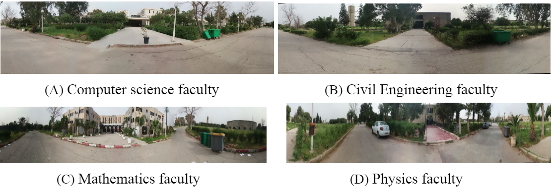
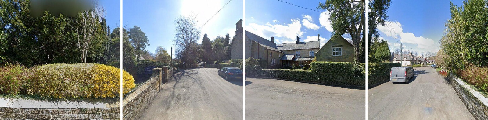
This paper presents a visual geo-localization system capable of determining the geographic locations of places (buildings and road intersections) from images without relying on GPS data. Our approach integrates three primary methods: Scale-Invariant Feature Transform (SIFT) for place recognition, traditional image processing for identifying road junction types, and deep learning using the VGG16 model for classifying road junctions. The most effective techniques have been integrated into an offline mobile application, enhancing accessibility for users requiring reliable location information in GPS-denied environments.
Read more7/23/2024

0
Cross-view geo-localization: a survey
Abhilash Durgam, Sidike Paheding, Vikas Dhiman, Vijay Devabhaktuni
Cross-view geo-localization has garnered notable attention in the realm of computer vision, spurred by the widespread availability of copious geotagged datasets and the advancements in machine learning techniques. This paper provides a thorough survey of cutting-edge methodologies, techniques, and associated challenges that are integral to this domain, with a focus on feature-based and deep learning strategies. Feature-based methods capitalize on unique features to establish correspondences across disparate viewpoints, whereas deep learning-based methodologies deploy convolutional neural networks to embed view-invariant attributes. This work also delineates the multifaceted challenges encountered in cross-view geo-localization, such as variations in viewpoints and illumination, the occurrence of occlusions, and it elucidates innovative solutions that have been formulated to tackle these issues. Furthermore, we delineate benchmark datasets and relevant evaluation metrics, and also perform a comparative analysis of state-of-the-art techniques. Finally, we conclude the paper with a discussion on prospective avenues for future research and the burgeoning applications of cross-view geo-localization in an intricately interconnected global landscape.
Read more6/17/2024
0
PIGEON: Predicting Image Geolocations
Lukas Haas, Michal Skreta, Silas Alberti, Chelsea Finn
Planet-scale image geolocalization remains a challenging problem due to the diversity of images originating from anywhere in the world. Although approaches based on vision transformers have made significant progress in geolocalization accuracy, success in prior literature is constrained to narrow distributions of images of landmarks, and performance has not generalized to unseen places. We present a new geolocalization system that combines semantic geocell creation, multi-task contrastive pretraining, and a novel loss function. Additionally, our work is the first to perform retrieval over location clusters for guess refinements. We train two models for evaluations on street-level data and general-purpose image geolocalization; the first model, PIGEON, is trained on data from the game of Geoguessr and is capable of placing over 40% of its guesses within 25 kilometers of the target location globally. We also develop a bot and deploy PIGEON in a blind experiment against humans, ranking in the top 0.01% of players. We further challenge one of the world's foremost professional Geoguessr players to a series of six matches with millions of viewers, winning all six games. Our second model, PIGEOTTO, differs in that it is trained on a dataset of images from Flickr and Wikipedia, achieving state-of-the-art results on a wide range of image geolocalization benchmarks, outperforming the previous SOTA by up to 7.7 percentage points on the city accuracy level and up to 38.8 percentage points on the country level. Our findings suggest that PIGEOTTO is the first image geolocalization model that effectively generalizes to unseen places and that our approach can pave the way for highly accurate, planet-scale image geolocalization systems. Our code is available on GitHub.
Read more4/9/2024

0
ProGEO: Generating Prompts through Image-Text Contrastive Learning for Visual Geo-localization
Chen Mao, Jingqi Hu
Visual Geo-localization (VG) refers to the process to identify the location described in query images, which is widely applied in robotics field and computer vision tasks, such as autonomous driving, metaverse, augmented reality, and SLAM. In fine-grained images lacking specific text descriptions, directly applying pure visual methods to represent neighborhood features often leads to the model focusing on overly fine-grained features, unable to fully mine the semantic information in the images. Therefore, we propose a two-stage training method to enhance visual performance and use contrastive learning to mine challenging samples. We first leverage the multi-modal description capability of CLIP (Contrastive Language-Image Pretraining) to create a set of learnable text prompts for each geographic image feature to form vague descriptions. Then, by utilizing dynamic text prompts to assist the training of the image encoder, we enable the image encoder to learn better and more generalizable visual features. This strategy of applying text to purely visual tasks addresses the challenge of using multi-modal models for geographic images, which often suffer from a lack of precise descriptions, making them difficult to utilize widely. We validate the effectiveness of the proposed strategy on several large-scale visual geo-localization datasets, and our method achieves competitive results on multiple visual geo-localization datasets. Our code and model are available at https://github.com/Chain-Mao/ProGEO.
Read more6/5/2024