Into the Unknown: Generating Geospatial Descriptions for New Environments

0
Sign in to get full access
Overview
• This paper presents a novel approach to generating geospatial descriptions for new environments, enabling AI systems to better understand and navigate unfamiliar spaces.
• The researchers developed a deep learning model that can create detailed, human-like descriptions of a location based on limited visual information, such as street-level imagery.
• The model leverages georeasoner and SpatialRGPT to reason about the spatial layout and semantics of a scene, and then generates natural language descriptions.
• This capability could benefit a range of applications, from improved vision-language navigation to more robust object grounding in virtual environments.
Plain English Explanation
Imagine you're dropped into a new place, like a foreign city, and you need to figure out your surroundings quickly. This paper presents a way for AI systems to do that - to generate detailed descriptions of a location based on limited visual information, like street-level photos.
The key idea is that the AI model can take a few images of an area and use that to reason about the spatial layout and semantics of the scene. It can then translate that understanding into natural language, describing what it sees in a way that sounds like a person explaining the environment.
This could be really useful for AI agents navigating unfamiliar spaces, whether that's a robot exploring a new building or an AR application helping a user find their way. By generating these geographic descriptions, the AI can build a better mental map of the area and communicate that to the user in an intuitive way.
The model draws on some other recent advances in AI, like georeasoning and spatial-language understanding, to piece together this comprehensive picture of a new environment. It's an important step towards giving AI a stronger sense of place and the ability to describe the world around it.
Technical Explanation
The paper introduces a novel deep learning model for generating geospatial descriptions of new environments based on limited visual input. The key innovation is the integration of georeasoning and spatial-language understanding capabilities to create detailed, human-like descriptions of a location.
The model first uses a computer vision module to extract relevant visual features from street-level imagery. It then applies a georeasoning module to infer the spatial layout and semantics of the scene, drawing insights about objects, surfaces, and the overall geometry.
This spatial understanding is then fed into a SpatialRGPT language generation module, which translates the spatial reasoning into natural language descriptions. The model is trained on a large dataset of human-written geospatial descriptions paired with corresponding street-level imagery.
The resulting system can generate detailed, human-like descriptions of new environments based on just a few images. This capability could benefit a range of applications, from improved vision-language navigation to more robust object grounding in virtual environments.
Critical Analysis
The paper presents a promising approach to generating geospatial descriptions, but it also acknowledges several limitations and areas for further research. For example, the model currently relies on street-level imagery, which may not be available or representative of all environments. Expanding the model to handle a wider range of visual inputs, such as aerial or indoor imagery, could broaden its applicability.
Additionally, while the generated descriptions are generally coherent and human-like, they may not always capture nuanced aspects of a scene or account for personal perspectives and biases. Incorporating more advanced language understanding and commonsense reasoning could help the model produce more contextually appropriate and diverse descriptions.
The authors also note that the training dataset, while large, may not fully capture the rich diversity of geospatial language used by humans. Exploring techniques for few-shot or zero-shot learning could enable the model to quickly adapt to new environments and styles of description.
Overall, this research represents an important step towards equipping AI systems with a stronger sense of place and the ability to communicate their understanding of new environments. Further advancements in this area could have significant implications for vision-language navigation, object grounding, and other applications that require robust spatial understanding and natural language generation.
Conclusion
This paper introduces a novel deep learning approach for generating detailed, human-like geospatial descriptions of new environments based on limited visual input. By integrating georeasoning and spatial-language understanding capabilities, the model can create descriptions that capture the spatial layout and semantics of a scene in a way that sounds natural and intuitive.
This capability could have far-reaching implications for a variety of AI applications, from improved vision-language navigation to more robust object grounding in virtual environments. By helping AI systems build a stronger understanding of their surroundings, this research represents an important step towards more intelligent and contextually aware artificial agents.
While the current model has some limitations, the authors have identified several promising directions for future work, such as expanding the range of visual inputs and improving the nuance and diversity of the generated descriptions. As the field of AI continues to advance, technologies like this could play a crucial role in bridging the gap between machines and the richly textured world we inhabit.
This summary was produced with help from an AI and may contain inaccuracies - check out the links to read the original source documents!
Related Papers
0
Into the Unknown: Generating Geospatial Descriptions for New Environments
Tzuf Paz-Argaman, John Palowitch, Sayali Kulkarni, Reut Tsarfaty, Jason Baldridge
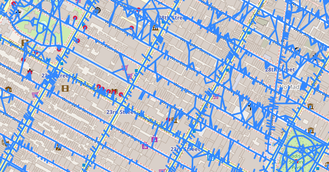
Similar to vision-and-language navigation (VLN) tasks that focus on bridging the gap between vision and language for embodied navigation, the new Rendezvous (RVS) task requires reasoning over allocentric spatial relationships (independent of the observer's viewpoint) using non-sequential navigation instructions and maps. However, performance substantially drops in new environments with no training data. Using opensource descriptions paired with coordinates (e.g., Wikipedia) provides training data but suffers from limited spatially-oriented text resulting in low geolocation resolution. We propose a large-scale augmentation method for generating high-quality synthetic data for new environments using readily available geospatial data. Our method constructs a grounded knowledge-graph, capturing entity relationships. Sampled entities and relations (`shop north of school') generate navigation instructions via (i) generating numerous templates using context-free grammar (CFG) to embed specific entities and relations; (ii) feeding the entities and relation into a large language model (LLM) for instruction generation. A comprehensive evaluation on RVS, showed that our approach improves the 100-meter accuracy by 45.83% on unseen environments. Furthermore, we demonstrate that models trained with CFG-based augmentation achieve superior performance compared with those trained with LLM-based augmentation, both in unseen and seen environments. These findings suggest that the potential advantages of explicitly structuring spatial information for text-based geospatial reasoning in previously unknown, can unlock data-scarce scenarios.
Read more7/1/2024

0
TGS: Trajectory Generation and Selection using Vision Language Models in Mapless Outdoor Environments
Daeun Song, Jing Liang, Xuesu Xiao, Dinesh Manocha
We present a multi-modal trajectory generation and selection algorithm for real-world mapless outdoor navigation in challenging scenarios with unstructured off-road features like buildings, grass, and curbs. Our goal is to compute suitable trajectories that (1) satisfy the environment-specific traversability constraints and (2) generate human-like paths while navigating in crosswalks, sidewalks, etc. Our formulation uses a Conditional Variational Autoencoder (CVAE) generative model enhanced with traversability constraints to generate multiple candidate trajectories for global navigation. We use VLMs and a visual prompting approach with their zero-shot ability of semantic understanding and logical reasoning to choose the best trajectory given the contextual information about the task. We evaluate our methods in various outdoor scenes with wheeled robots and compare the performance with other global navigation algorithms. In practice, we observe at least 3.35% improvement in traversability and 20.61% improvement in terms of human-like navigation in generated trajectories in challenging outdoor navigation scenarios.
Read more8/9/2024
🌿
0
Towards Natural Language-Guided Drones: GeoText-1652 Benchmark with Spatial Relation Matching
Meng Chu, Zhedong Zheng, Wei Ji, Tingyu Wang, Tat-Seng Chua
Navigating drones through natural language commands remains challenging due to the dearth of accessible multi-modal datasets and the stringent precision requirements for aligning visual and textual data. To address this pressing need, we introduce GeoText-1652, a new natural language-guided geo-localization benchmark. This dataset is systematically constructed through an interactive human-computer process leveraging Large Language Model (LLM) driven annotation techniques in conjunction with pre-trained vision models. GeoText-1652 extends the established University-1652 image dataset with spatial-aware text annotations, thereby establishing one-to-one correspondences between image, text, and bounding box elements. We further introduce a new optimization objective to leverage fine-grained spatial associations, called blending spatial matching, for region-level spatial relation matching. Extensive experiments reveal that our approach maintains a competitive recall rate comparing other prevailing cross-modality methods. This underscores the promising potential of our approach in elevating drone control and navigation through the seamless integration of natural language commands in real-world scenarios.
Read more8/1/2024
📉
0
Hierarchical Spatial Proximity Reasoning for Vision-and-Language Navigation
Ming Xu, Zilong Xie
Most Vision-and-Language Navigation (VLN) algorithms are prone to making decision due to a lack of visual common sense and insufficient reasoning capabilities. To address this issue, we propose a Hierarchical Spatial Proximity Reasoning (HSPR) method. First, we introduce a scene understanding auxiliary task to help the agent build a knowledge base of hierarchical spatial proximity. This task utilizes panoramic views and object features to identify types of nodes and uncover the adjacency relationships between nodes, objects, and between nodes and objects. Second, we propose a multi-step reasoning navigation algorithm based on hierarchical spatial proximity knowledge base, which continuously plans feasible paths to enhance exploration efficiency. Third, we introduce a residual fusion method to improve navigation decision accuracy. Finally, we validate our approach with experiments on publicly available datasets including REVERIE, SOON, R2R, and R4R. Our code is available at https://github.com/iCityLab/HSPR.
Read more8/30/2024